Work continues to address post-fire water quality impacts in Poudre Watershed
In Fall 2022, CPRW will continue to work with partners to address critical post-fire issues in priority watersheds that were impacted by the historic Cameron Peak Fire of 2020. Following large-scale fires like Cameron Peak, burn areas have a higher potential for increased runoff, stream flows and erosion in streams and gullies, causing water quality issues that persist for many years.
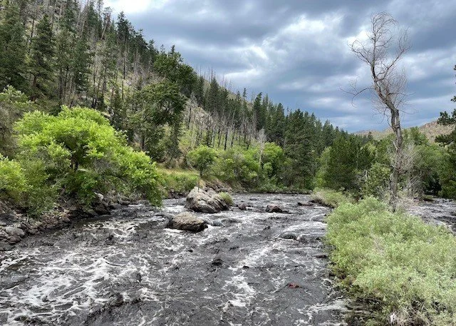
A “black water” event on the Poudre River
Over the next six weeks, the Coalition for the Poudre River Watershed (CPRW) is working with local partners to install point-based Best Management Practices (BMPs) in key locations that are intended to help slow future pulses of sediment and promote deposition (laying down) of sediment in floodplains with the goal of protecting water quality. Types of BMPs used may include contour wattles, large woody material stabilization, native rock stabilization, post-assisted log structures, tree felling, and willow/riparian vegetation staking.
Rock stabilization
Contour wattles
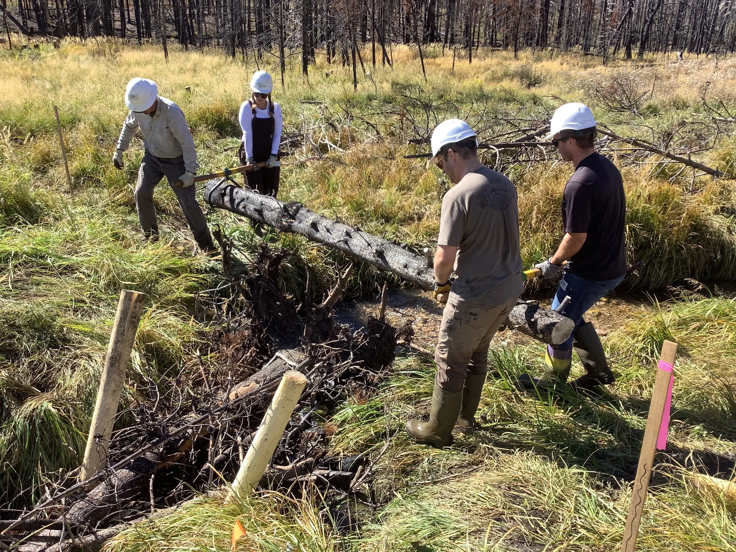
Volunteers from Wildlands Restoration Volunteers (WRV) install post-assisted log structures (PALS), a low-tech restoration structure that mimic and promote accumulation of large woody debris (LWD) and are designed to influence hydraulic, hydrologic and geomorphic processes. PALS are designed to influence hydraulics across a range of flows, and depending on the design, may force the creation of an upstream pond (University of Utah, 2019)
The Poudre Watershed is a critical source of water for the region and excess sediment can degrade water quality. The fall 2022 projects are meant to complement the aerial mulch program that CPRW and partners have led the last two years, creating a mosaic of post-fire treatments intended to help protect water quality. Project locations are determined in part through a prioritization process using soil burn severity analysis and models assessing potential for debris flow and hillslope erosion generation.
Cameron Peak Fire Watershed Prioritization Map
Through project funding from Colorado Department of Public Health and Environment (CDPHE) and Colorado Water Conservation Board (CWCB), CPRW and partners will implement projects on a mix of public and private lands using hand crews, including local volunteers, youth corps, and a local contractor. Locations for 2022 projects, covering approximately 45 acres of land, include two sites that impact the mainstem of the Poudre River on state owned properties west of Rustic. Fall 2022 project locations also include key tributaries impacting water quality in the watershed, including Upper Elkhorn Creek, Upper Black Hollow, and the South Fork of the Poudre River. CPRW is planning to conduct similar projects in 2023. CPRW and partners from Colorado State University will monitor impacts of the treatments through 2025.
If you have observed excess sediment and erosion issues in the Cameron Peak Fire area, please reach out to Shayna Jones at shayna@poudrewatershed.org so we can assess the location and determine if the area is a good fit for the current grant’s scope. To learn more about CPRW's Post-Fire Restoration Program visit: www.poudrewatershed.org/cpf-restoration