Lazy D Ranch
Project Overview
The Lazy D project site is part of a priority HUC14 for post-fire restoration (Upper South Fork Cache La Poudre) that connects directly with one of the key main tributaries to the Cache La Poudre mainstem – the South Fork of the Cache la Poudre. CPRW and its partners identified this priority location through a stakeholder and science-driven Hazard Assessment Framework.
CPRW and the project team implemented a series of low-tech, process-based restoration treatments intended to reduce velocity of seasonal and monsoon flows in the upper portions of the tributary, increase sediment storage behind structures and in floodplain overbank areas, reduce channel erosion in areas with bank incision, and reduce hillslope erosion contributing to excess flows and sediment.
Lazy D Ranch Post-Fire Mitigation Plan (Courtesy of Ayers Associates)
Lazy D Ranch Post-Fire Mitigation Plan (Courtesy of Ayers Associates)
Post-Fire Treatment(s)
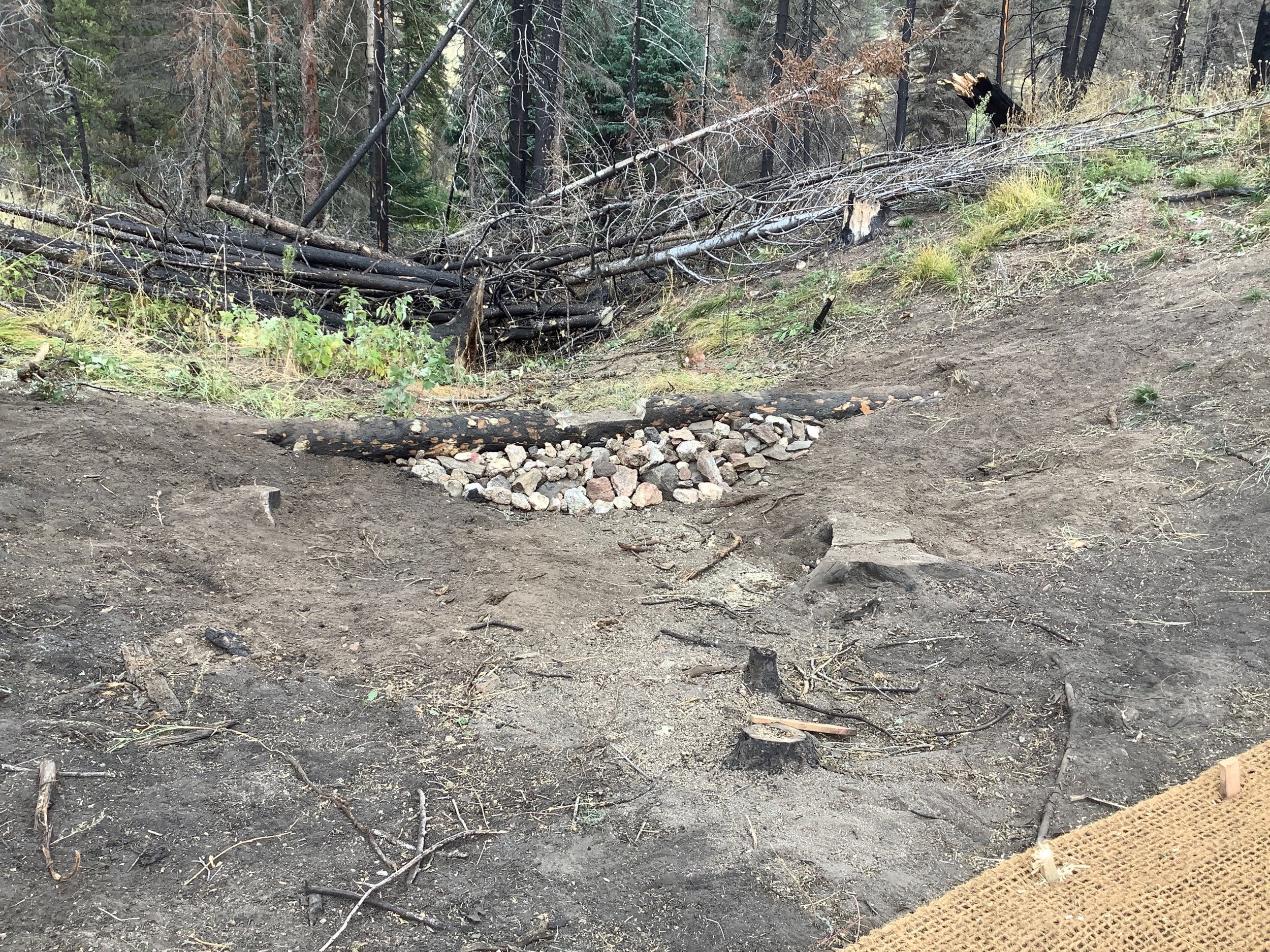
Native Rock Stabilization Features (4 total) - Native rock was harvested on-site and placed, typically by hand, to stabilize headcuts and impede channel incision. This helps improve water quality by stabilizing actively eroding channels and limiting upstream incision.
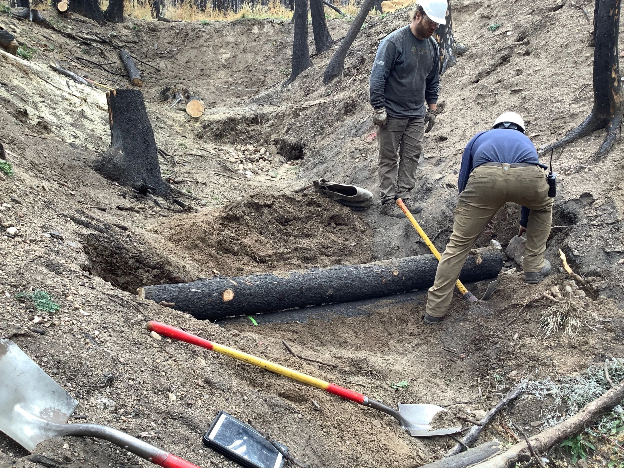
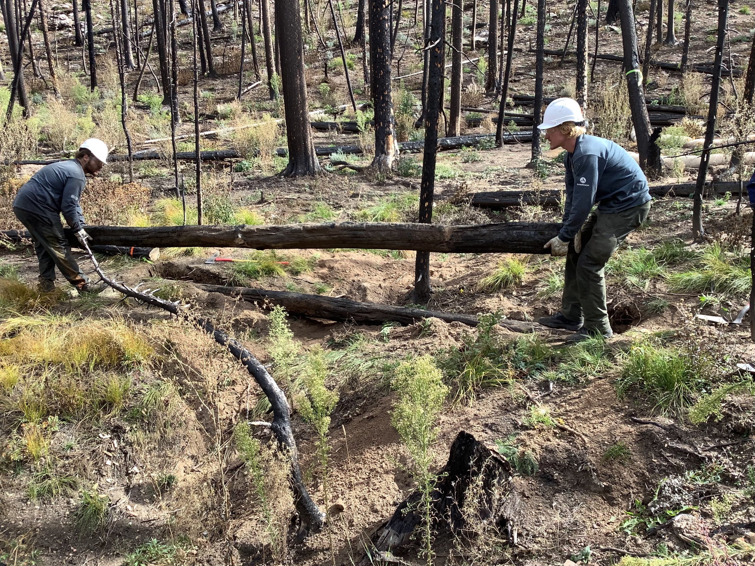
Tree Fell Structures (4 total) - Standing burned trees were strategically felled into channels to enhance existing depositional zones and large wood material recruitment. Trees were interlocked to reduce flow velocities, catch debris, and provide sediment storage.
Large Wood Stabilization Structures (5 total) - On-site large woody material was strategically placed and interlocked in the channel and on the streambed to initiate and simulate natural wood accumulation. Log Structures provide opportunity for sediment storage behind the structures while promoting floodplain connectivity, additional wood recruitment, aquatic habitat complexity, and riparian health.
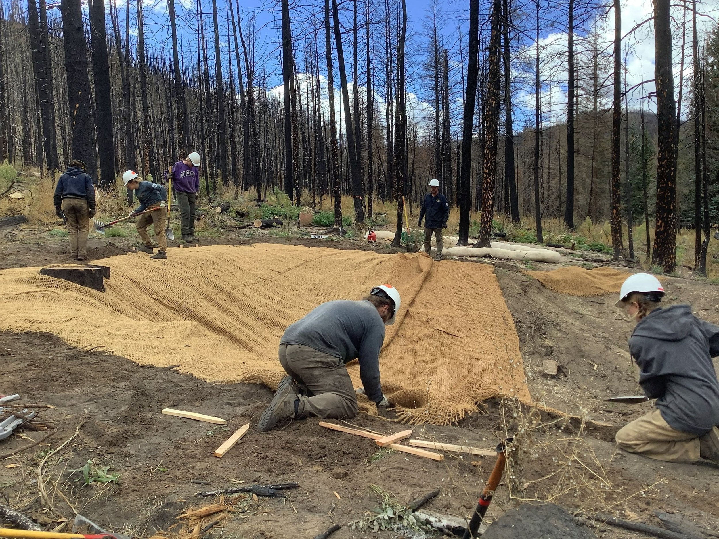
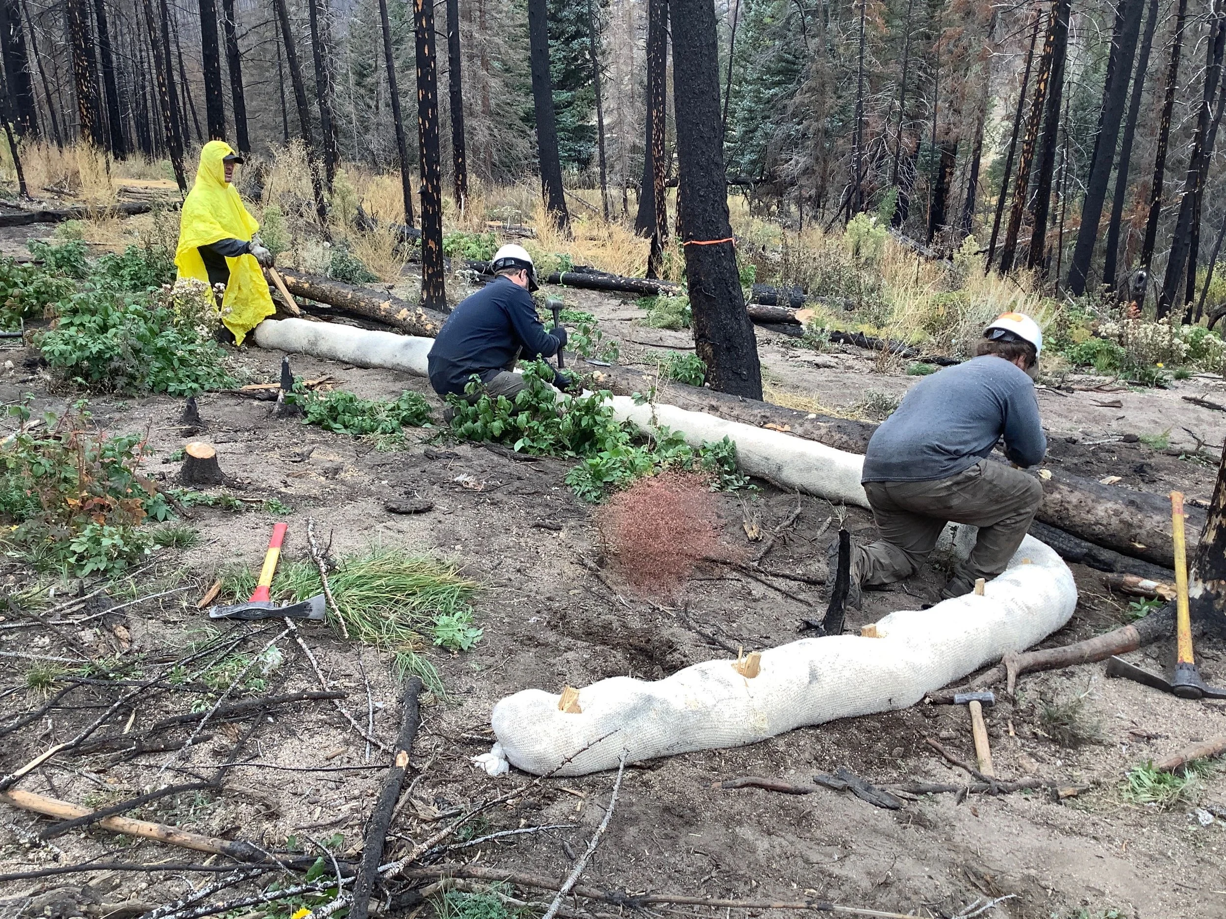
Contour Wattles (13 total in upper and lower portions of project area) - Biodegradable wattles were staked parallel to contours on hillslopes to reduce erosion and increase sediment deposition on vulnerable hillslopes, alluvial fans and small gullies. In the Lazy D project site, the contour wattles are focused on the upstream hillslope areas and downstream floodplain areas, to help provide an opportunity for sediment deposition. These treatments are intended to help reduce impacts of widespread sheet erosion that is causing downstream water quality impairments.
Seeding and Erosion Control Mats - Native seed was placed on several heavily eroding ephemeral channels in the project area, along with the erosion control mats, to support vegetative growth. It is intended to help stabilize sediment deposition expected in the area and provide stability to help limit additional erosion in the area.
Project Goals
Provide greater stability during typical monsoon thunderstorm events
Decrease water quality degradation due to excess sediment entering the stream system
Use low-tech process-based restoration techniques to meet the project objectives
Monitoring
A variety of monitoring techniques are implemented upstream, within and downstream of the project area, to help estimate and quantify sediment storage and water chemistry trends. Techniques include:
Lidar, Survey, and Sediment Staking to measure volume of sediment deposition
HOBO Loggers, staff gauges and groundwater wells to measure flow and stage characteristics
Grab Samples to measure pollutant concentrations and assess trends in changes in stream chemistry over time
Bank Erosion Hazard Index (BEHI) to measure changes in bank erosion potential
Project Collaborators
Ayres Associates
Larimer County Conservation Corps
Wildlands Restoration Volunteers
Funder(s)
Colorado Department of Public Health and Environment (CDPHE)
Project Timeline
Completed - Summer 2022