Poudre Canyon Stand Scale Treatment #1
Red Feather Lakes Area Wildfire Defense Project
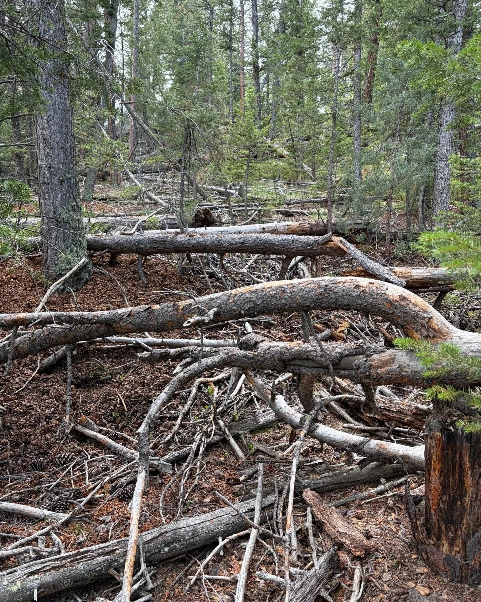
The forest type in the treatment area is dry mixed-conifer, consisting of mostly dense, mixed-age Douglas-fir with pockets of ponderosa pine, and juniper as a significant mid/understory component.
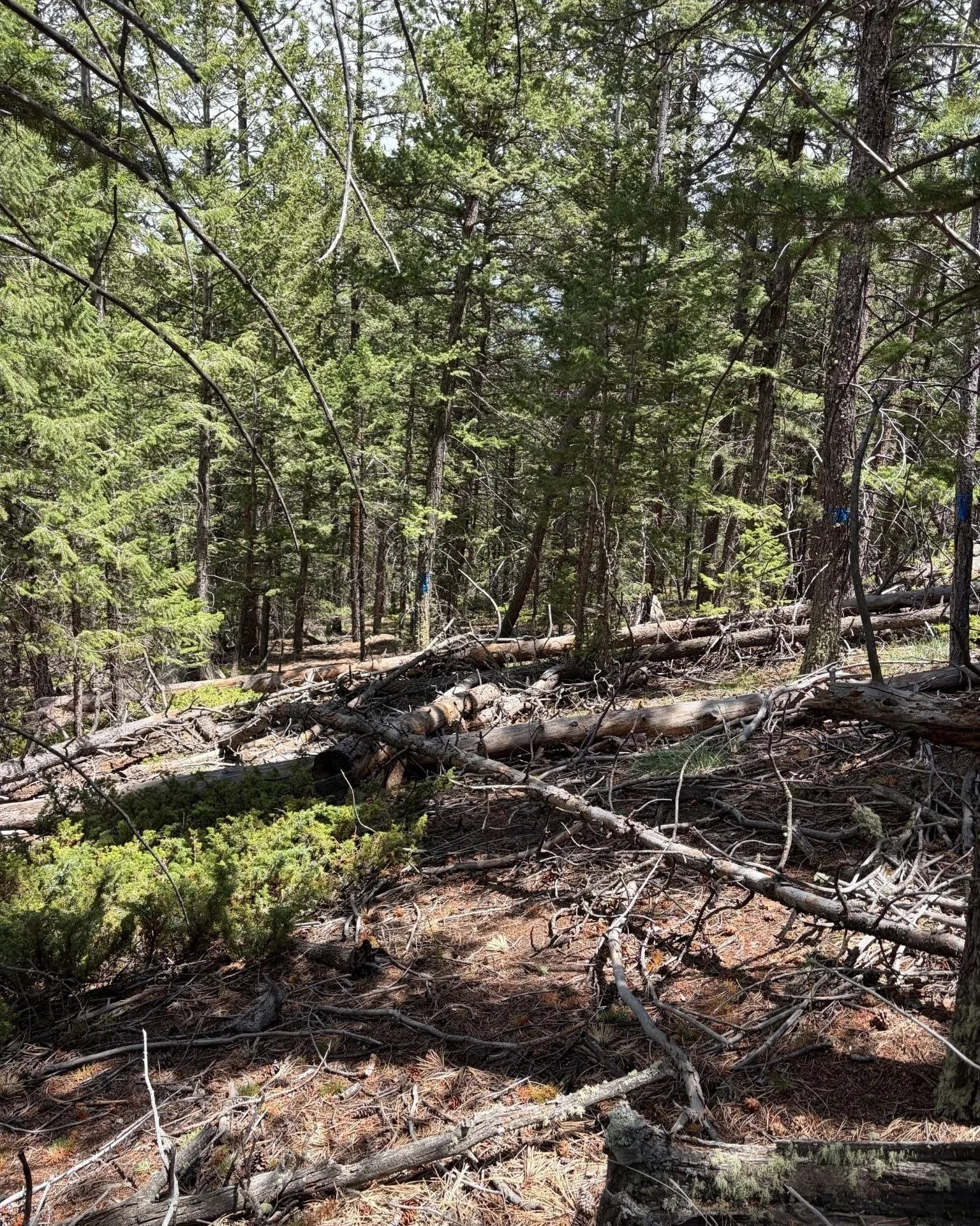
The project area, located within the Poudre Canyon Fire Protection District, totals 74.6 acres across six different private properties along county road 68C
Introduction and Purpose of Project
The Red Feather Lakes Area Wildfire Defense Project, jointly administered by Larimer County Office of Emergency Management and Coalition for the Poudre River Watershed and funded through the US Department of Agriculture Community Wildfire Defense Grant (CWDG) program, focuses on four main objectives to improve wildfire readiness:
1. Reduction of hazardous fuels in open space, along roadways, and on private properties
2. Reduction of risk to properties through hazard assessment and defensible space treatments
3. Improved evacuation plans, procedures, and routes
4. Enhanced community capacity to handle woody biomass generated during these treatments
The Poudre Canyon Stand Scale Treatment #1 was prioritized by the Poudre Canyon Community Wildfire Protection Plan and Poudre Canyon Fire Protection District and will be implemented in the fall/winter of 2026. This project will address objective 1, and continue to build local capacity through building up a contractor base.
Project Area & Description
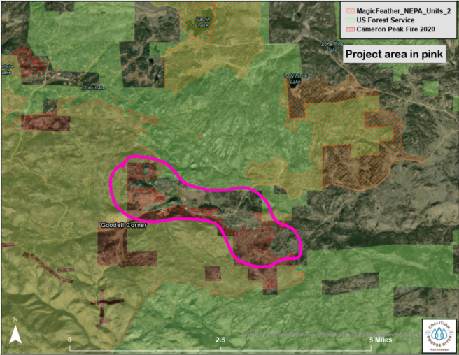
The project area, located within the Poudre Canyon Fire Protection District, totals 74.6 acres across six different private properties along county road 68C (see map). The forest type in the treatment area is dry mixed-conifer, consisting of mostly dense, mixed-age Douglas-fir with pockets of ponderosa pine, and juniper as a significant mid/understory component. Each property making up this project has its own site specific characteristics, but generally the landscape consists of open meadows in the flat areas and valley bottoms that give way to densely forested slopes, especially on north facing aspects. On some of the properties, past beetle kill and wind throw have created a buildup of down woody debris and increased fuel loads. The treatment area is bordered on the north by the federally managed Roosevelt National Forest, and to the west and south are significant swaths of dead standing trees left in the wake of the 2020 Cameron Peak Fire.
The Poudre Canyon community has identified these parcels as a priority area for treatment and adjacent landowners have allowed access to the space through their properties. Once completed, this treatment will advance a landscape level strategy by adding to a band of treatments in the area including the ongoing USFS Magic Feather prescribed burn, and the previously completed treatments at the Drala Mountain Center which played a role in halting the westward progress of the Cameron Peak fire in 2020.
Treatment Objectives
This project will reduce hazardous fuels and restore a historic, more open forest structure that favors ponderosa pine in the future while also serving as a fuelbreak to any wildfire approaching the community from bordering national forest to the north and west of the project area. Additionally, this treatment will increase tree vigor through reduced competition and restore forest structural conditions that support characteristic a low - to mixed-severity fire regime increasing the landscape’s resilience to potential future wildfire.
Project Timeline: Fall/Winter 2026
Project Collaborators
Coalition for the Poudre River Watershed (CPRW)
Larimer County Office of Emergency Management
Poudre Canyon Fire Protection District
Funders
U.S. Forest Service - Community Wildfire Defense Grant (CWDG)