Project Overview
Ratville was determined to be a high priority site to meet CPRW water quality objectives and US Forest Service values. This site ranked 2 of 25 in CPRW’s prioritization. Portions of the watershed were mulched in 2022. The combination of aerial and point mitigation treatments is a proactive strategy to improve water quality and roadway resiliency within severely burned watersheds like Ratville.
According to the latest burn severity map, 100% of the watershed contributing to this site was burned during the Cameron Peak Fire. The JW Hazard Assessment concluded that this watershed presents “moderate” hazard. A hydrologic analysis performed by Enginuity Engineering Solutions suggested that the post-fire flows at a location 1.5 miles downstream of the site would increase by 10 times compared to pre-fire flows for 10-year or less events due to the fire alone. Post-fire runoff has and will continue to result in increased sediment and nutrient inputs from adjacent hillslopes to stream systems, thereby degrading water quality and aquatic habitat. Fire-affected hydrology will also result in channel downcutting, reduced floodplain connectivity, and impairment of ecological processes. In addition, the crossing at USFS Road NF-350 that is used by residents of Ratville and Monument Gulch is at risk of washing out due to increased flows and upstream movement of headcuts.
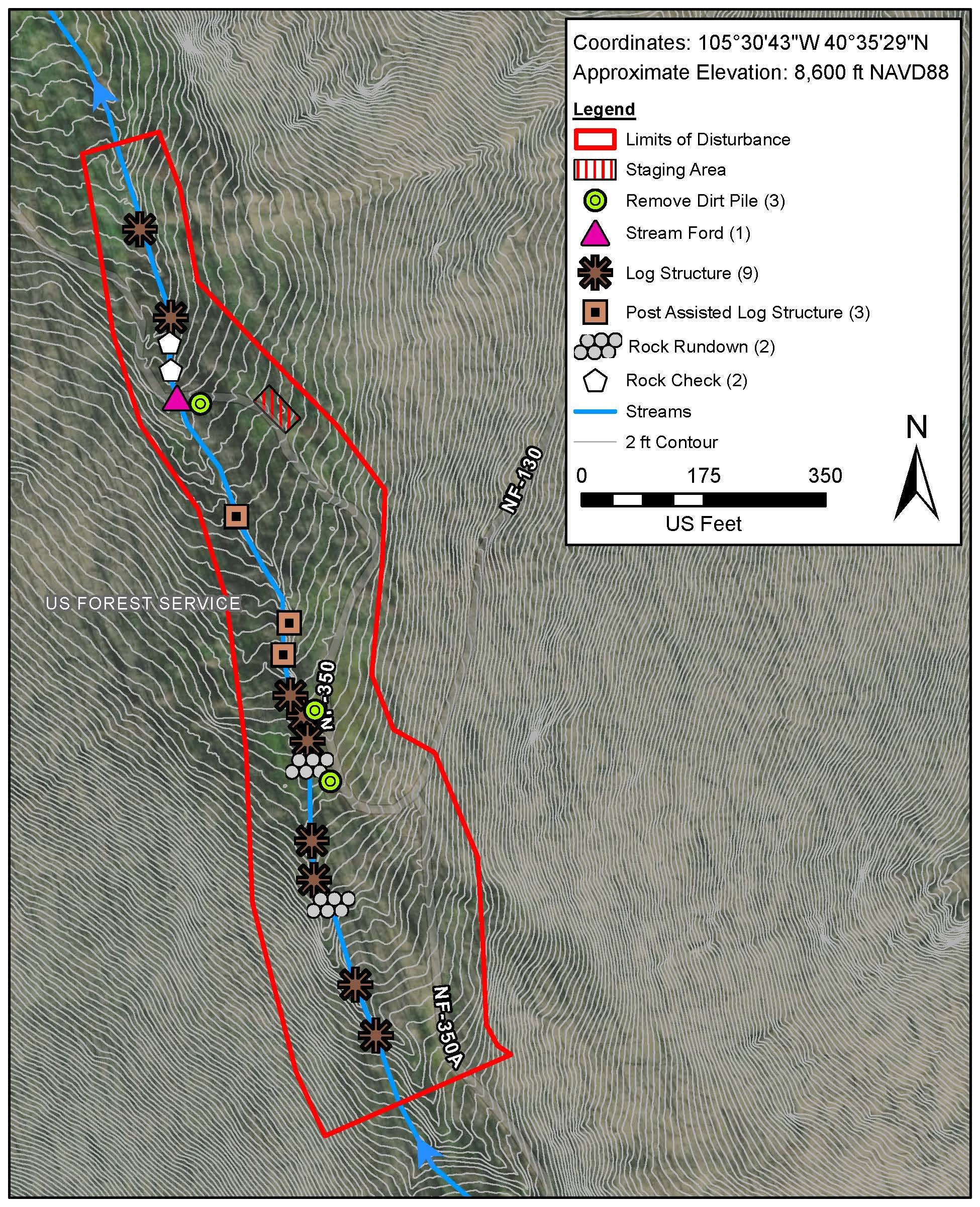
Ratville Post-Fire Mitigation Plan (Courtesy of Ayers Associates)
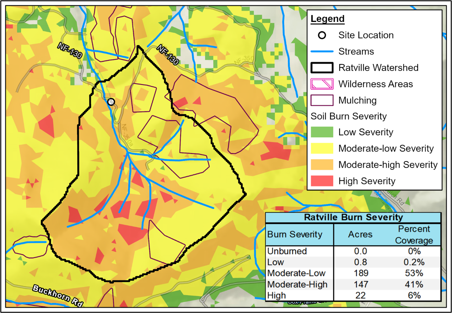
Ratville burn severity map (Courtesy of Ayers Associates)
Post-Fire Treatment(s)
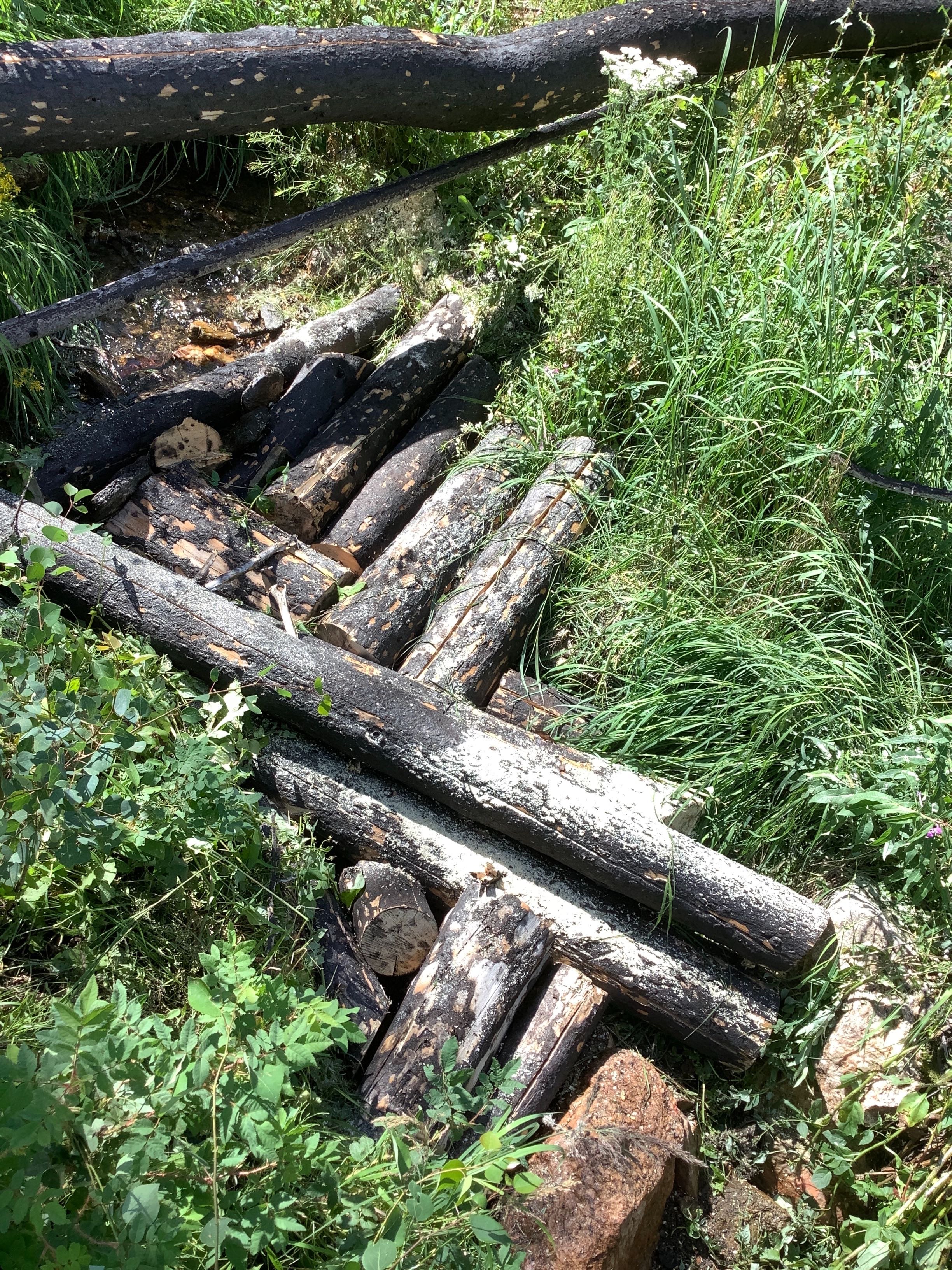
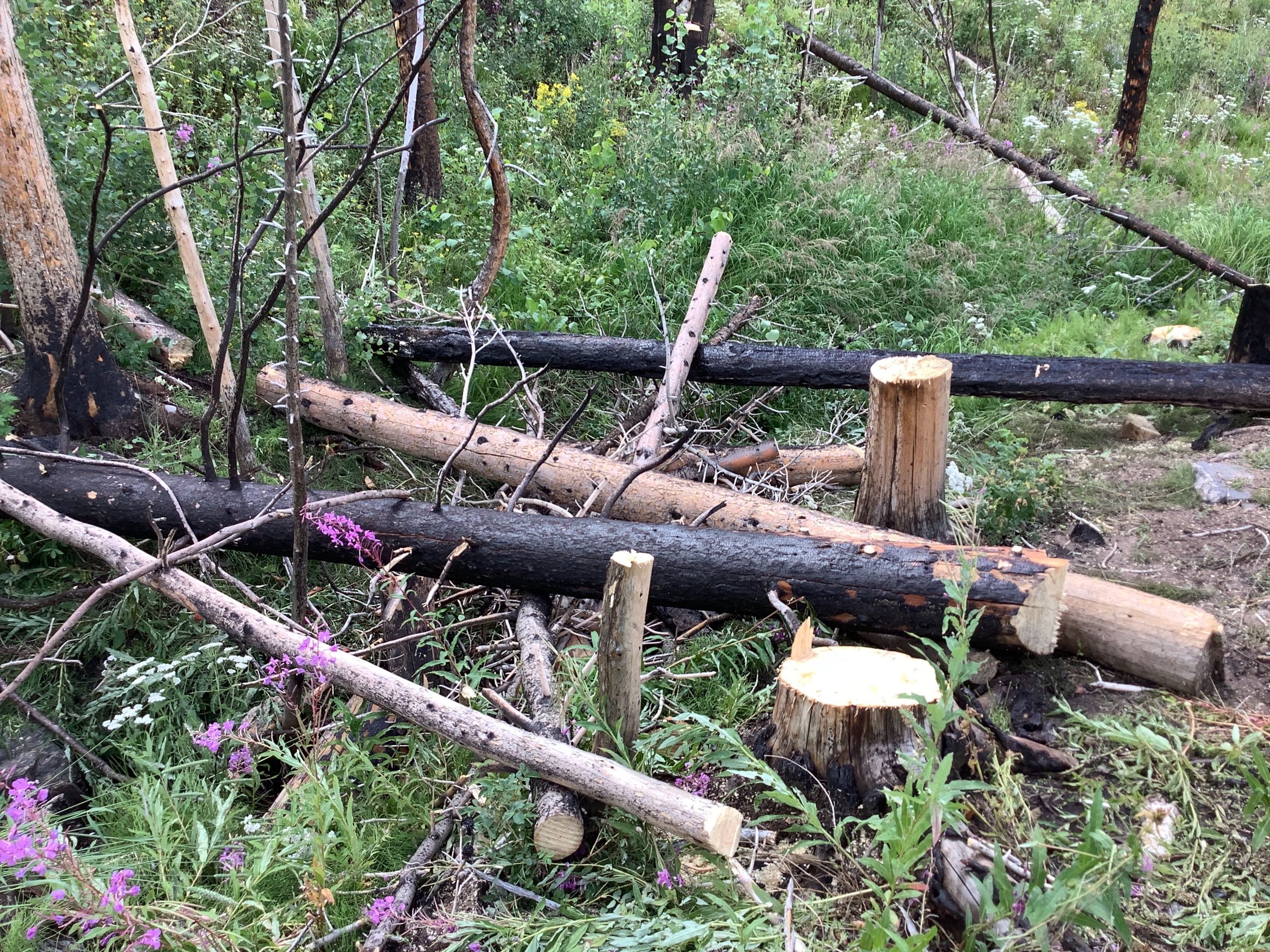
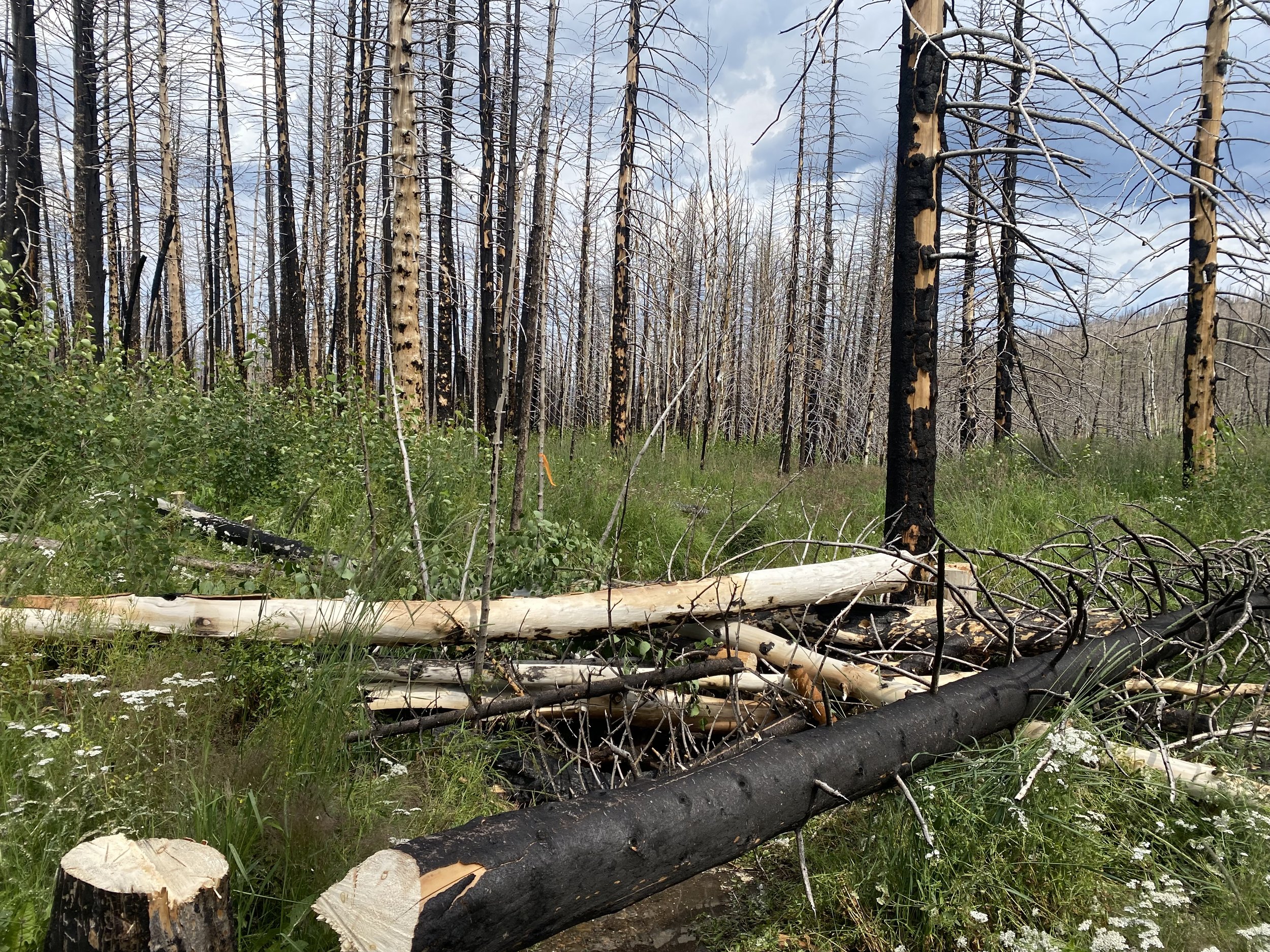
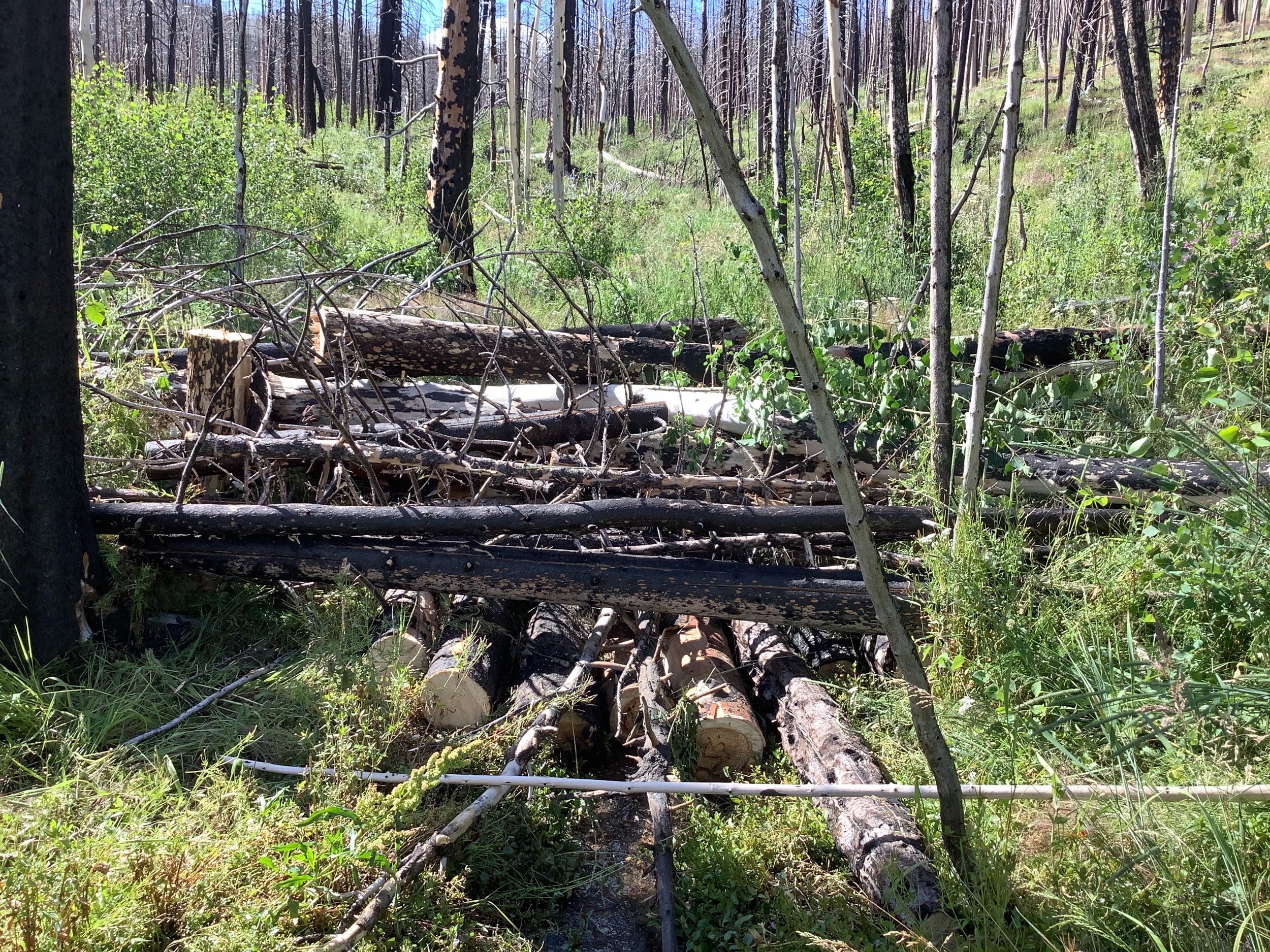
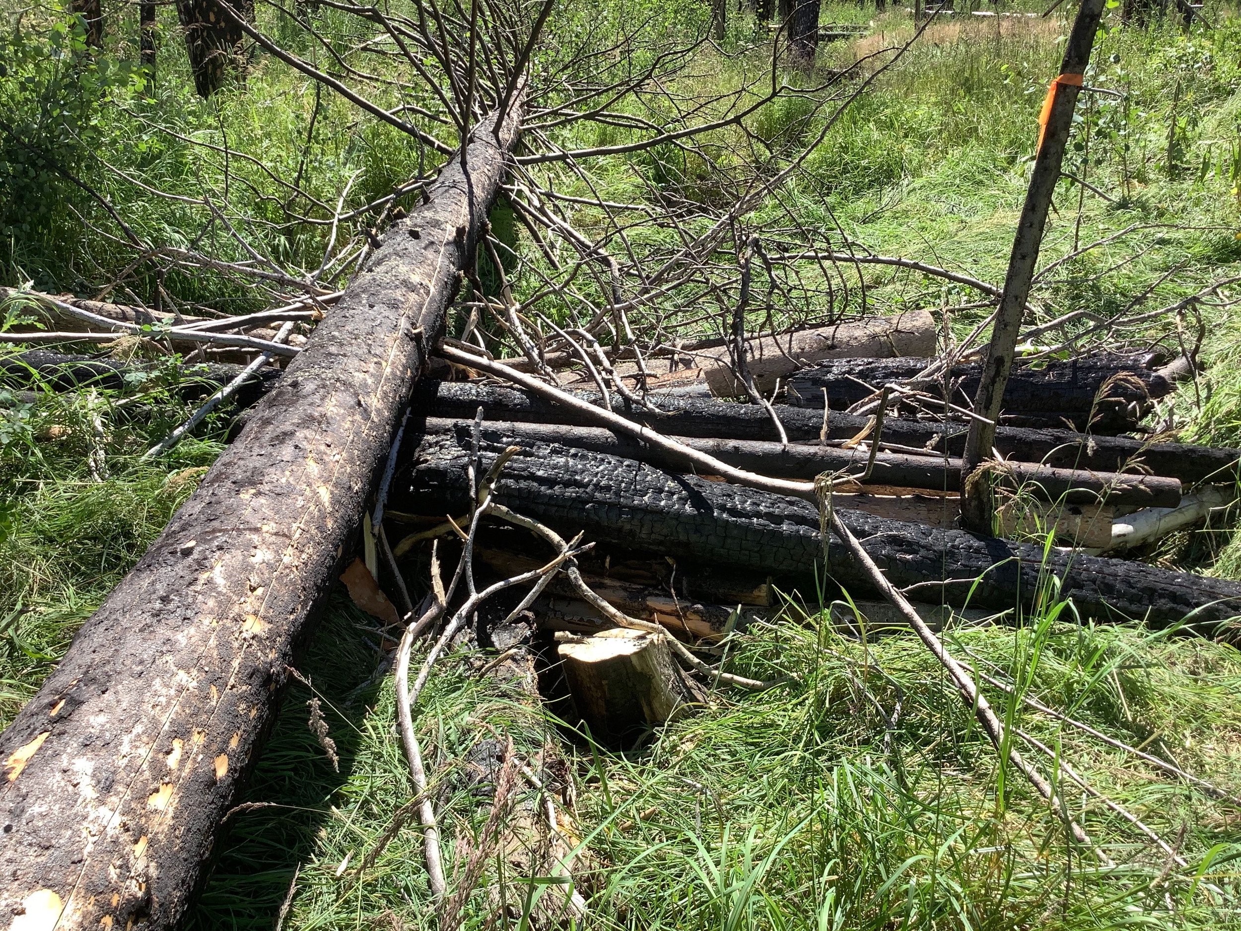
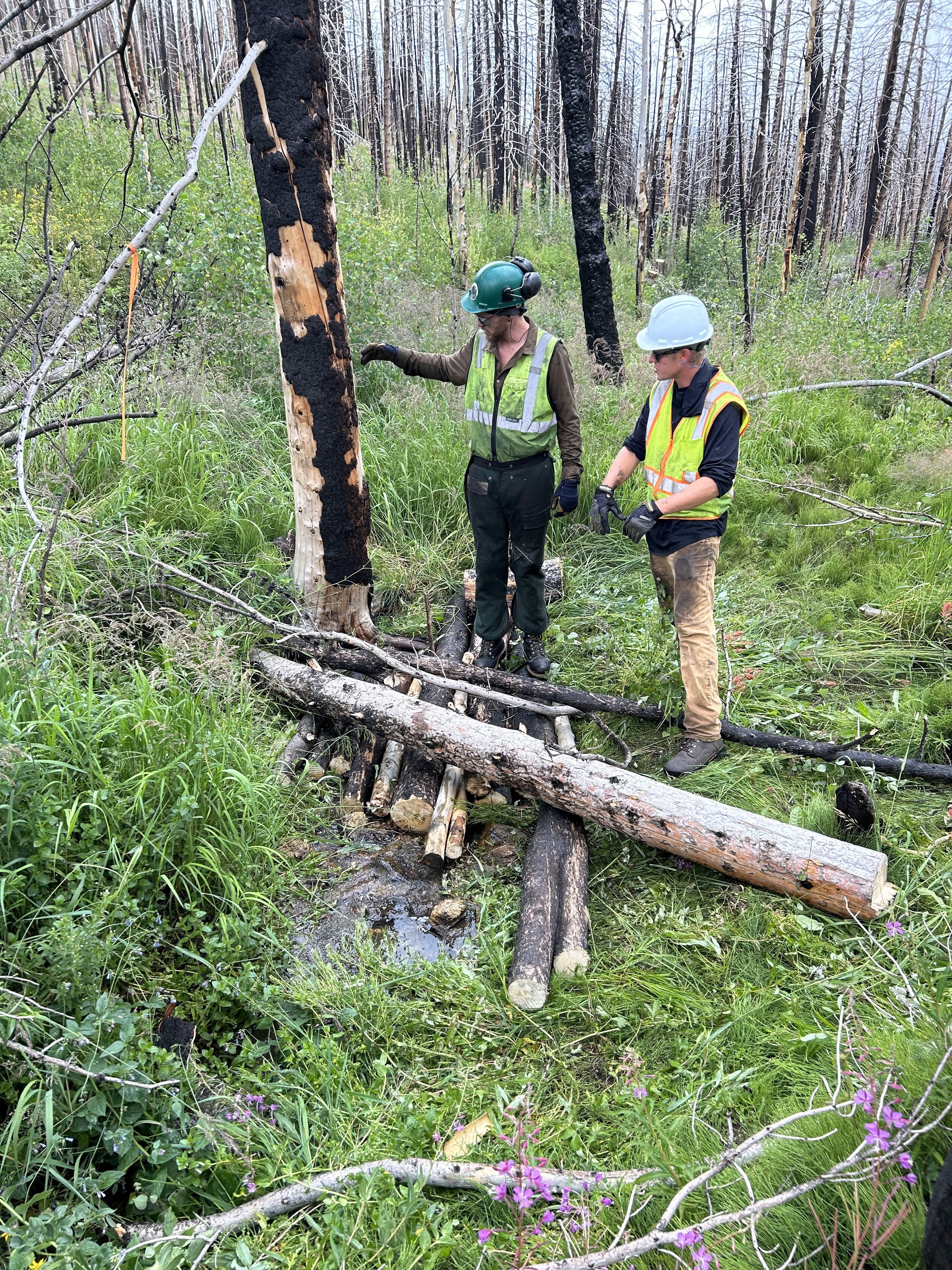
Log Structures (21 total) – Large woody material was placed and interlocked in the channel to increase roughness, reduce velocities, and enhance deposition. These features will reduce flow velocities by acting as speed bumps in addition to reducing impacts on the downstream stream ford. Log structures will also return flow to the overbanks, reducing incision and rehabilitating the floodplain. On-site burnt material will be primarily used. These features were field fit by the design team and placed to encourage sediment deposition and limit risk to NF-350.
Native Rock Rundown (1) – Native rock was harvested on-site and placed, typically by hand, to stabilize headcuts and impede channel incision. Rock is placed at the bottom of a headcut to reduce drop scour and arrest upstream migration of small headcuts. This will improve water quality by stabilizing actively eroding channels and limiting upstream incision.
Armored Crossing (1)
Project Goals
Provide greater stability during typical monsoon thunderstorm events
Decrease water quality degradation due to excess sediment entering the stream system
Use low-tech process-based restoration techniques to meet the project objectives
Project Collaborators
U.S. Forest Service
Ayres Associates
AloTerra Restoration Services
Funder(s)
Colorado Department of Public Health and Environment (CDPHE)
Project Timeline
Complete - Summer 2023