Sheep Creek at Norman Fry
Cameron Peak Post-Fire Restoration
Project Overview
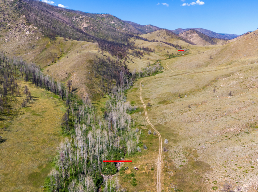
Sheep Creek was determined to be a high priority site to meet our water quality objectives, including the pursuit of a layered treatment approach to post-fire restoration. This site ranked second in CPRW’s prioritization. It is located downstream of high severity burn areas adjacent to the Black Hollow watershed. There are no Wilderness Areas within this watershed, so priority areas for hillslope erosion received mulching in 2021. Human land use impacts, such as grazing and channel realignment and confinement, have likely degraded the system prior to the wildfire, but the wildfire will only exacerbate this degradation.
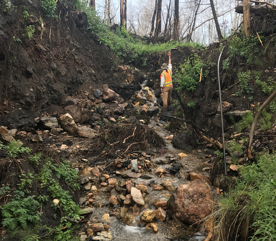
The Cameron Peak Fire enveloped the entire watershed with varying levels of burn severity. The JW Hazard Assessment concluded that most of the Sheep Creek watershed was a high hazard system. A hydrologic analysis performed by Enginuity Engineering Solutions indicated that the post-fire flows would increase seven-fold compared to pre-fire flows for 10-year or less events due to the fire alone. This increased runoff will result in greater sediment and nutrient inputs from adjacent hillslopes to stream systems, thereby degrading water quality and aquatic habitat. The fire-affected hydrology will also likely result in channel widening and downcutting, reduced floodplain connectivity, and impairment of ecological processes.
Phase 1 of this project was performed on Sheep Creek by CPRW between 2021 and 2022 downstream of the proposed project extents. That work included in-channel fill and stabilization to impede upstream movement of a 12-ft headcut by CPRW, as well as log structures, stream crossings, and headcut mitigation by the NRCS Emergency Watershed Protection Program. Phase 2 work benefits completed projects downstream and enhances water quality and stream health outcomes along Sheep Creek.

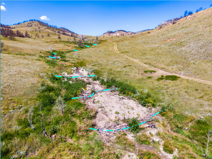
Sheep Creek at Norman Fry Rd. Post-Fire Mitigation Plan (Courtesy of Ayers Associates)

Sheep Creek at Norman Fry Rd Watershed Burn Severity (Courtesy of Ayers Associates)
Phase 1: Sheep Creek/Black Hollow
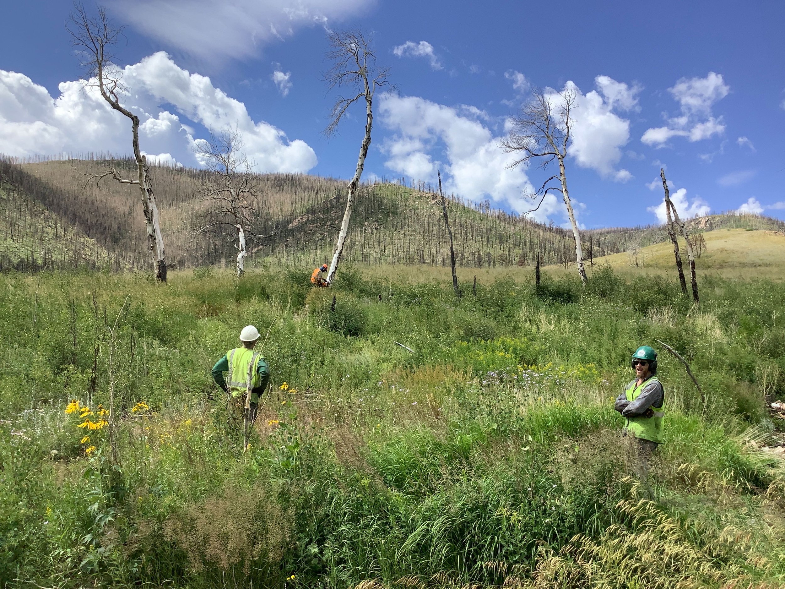
CPRW and partners selected Sheep Creek/Black Hollow based on hazard assessment results, as well as due to spatial analysis showing opportunity to maximize benefit to watershed values considering other projects underway in the area. The Black Hollow drainage is another CFRI top ten high reward watershed for hillslope erosion treatment. This is also the location of the flood and debris flow event that resulted in the tragic loss of life in summer 2021. The Sheep Creek/Black Hollow drainage is adjacent to this priority area and also has a high probability of post-fire debris flow. The area is one of the top-ranking watersheds for hillslope erosion based on the CFRI assessment, has a high risk of probable increased post-fire runoff, and an overall ranking of hazard assessment of “Highest” in the overall guiding 2021 JW Associates assessment. This area also contained a unique opportunity to leverage existing work and treatments in the area, which included Emergency Watershed Protection projects to protect life and property, and aerial mulching work to help stabilize hillslopes. The Phase 1 CPRW project focused on rock stabilization of an extremely large headcut forming upstream of a Emergency Watershed Protection project. The project site is located on private property.
Post-Fire Treatment(s)
Phase 1:
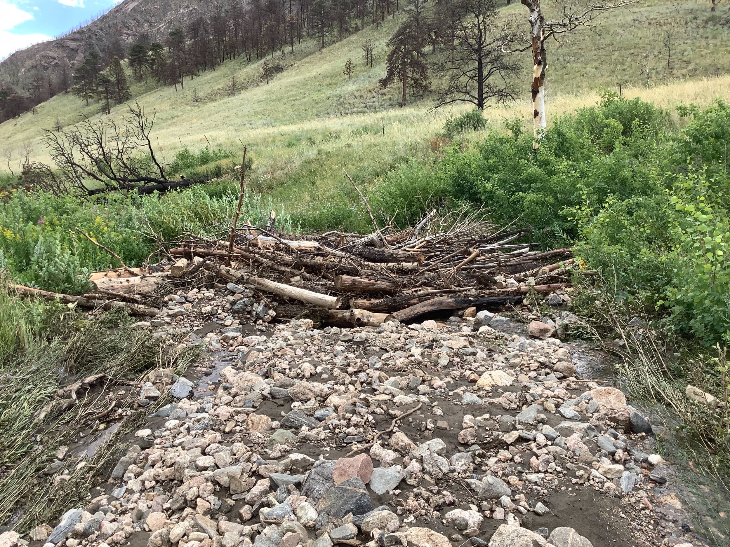
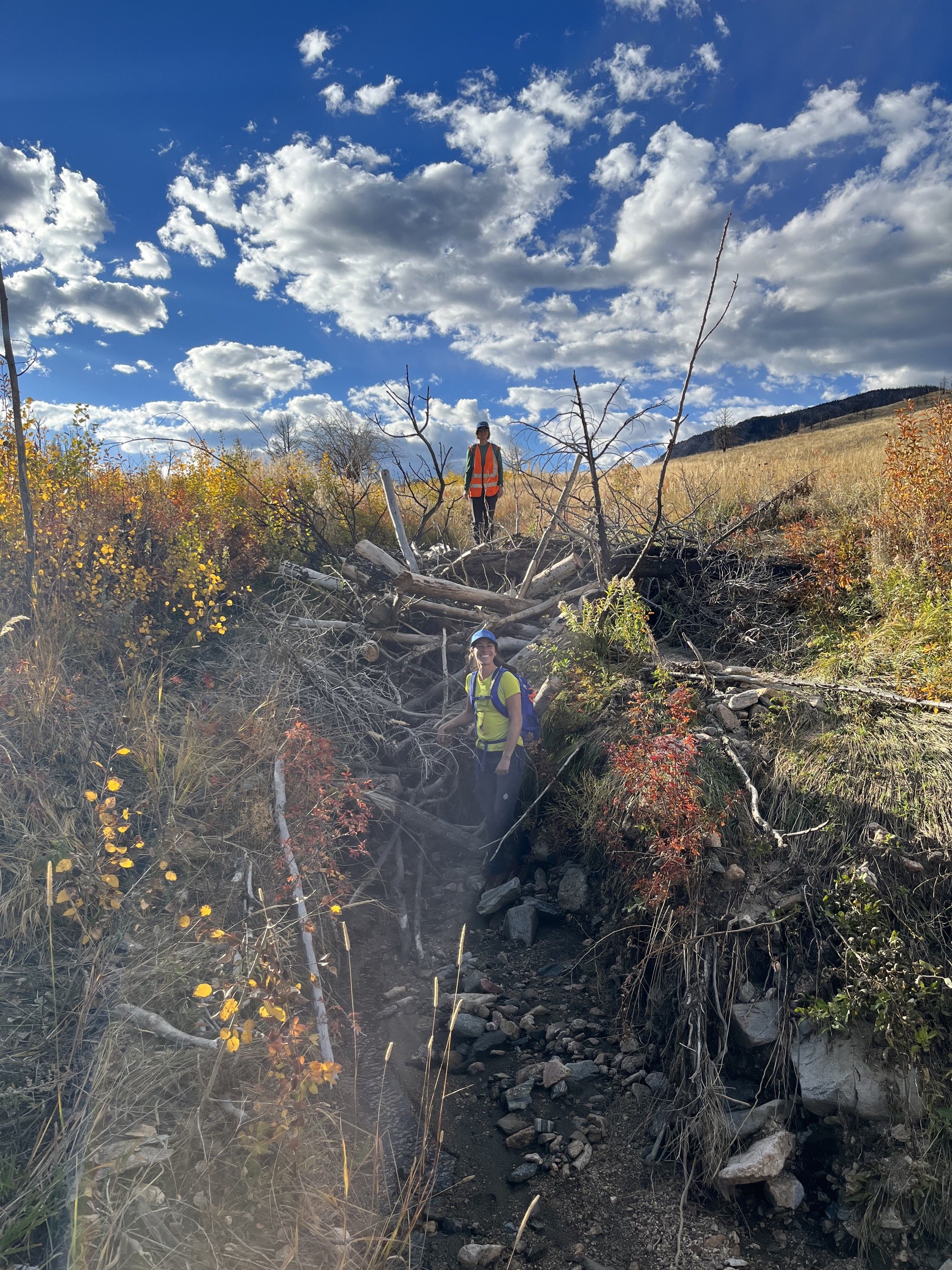
Log Jams
Willow Wattles - Use on site native material to encourage deposition and debris accumulations
Willow Staking
Rock Rundown - Native rock was harvested on-site or imported as needed and placed, typically by hand, to stabilize headcuts and impede channel incision. This will improve water quality by stabilizing actively eroding channels and limiting upstream incision.
Phase 2:
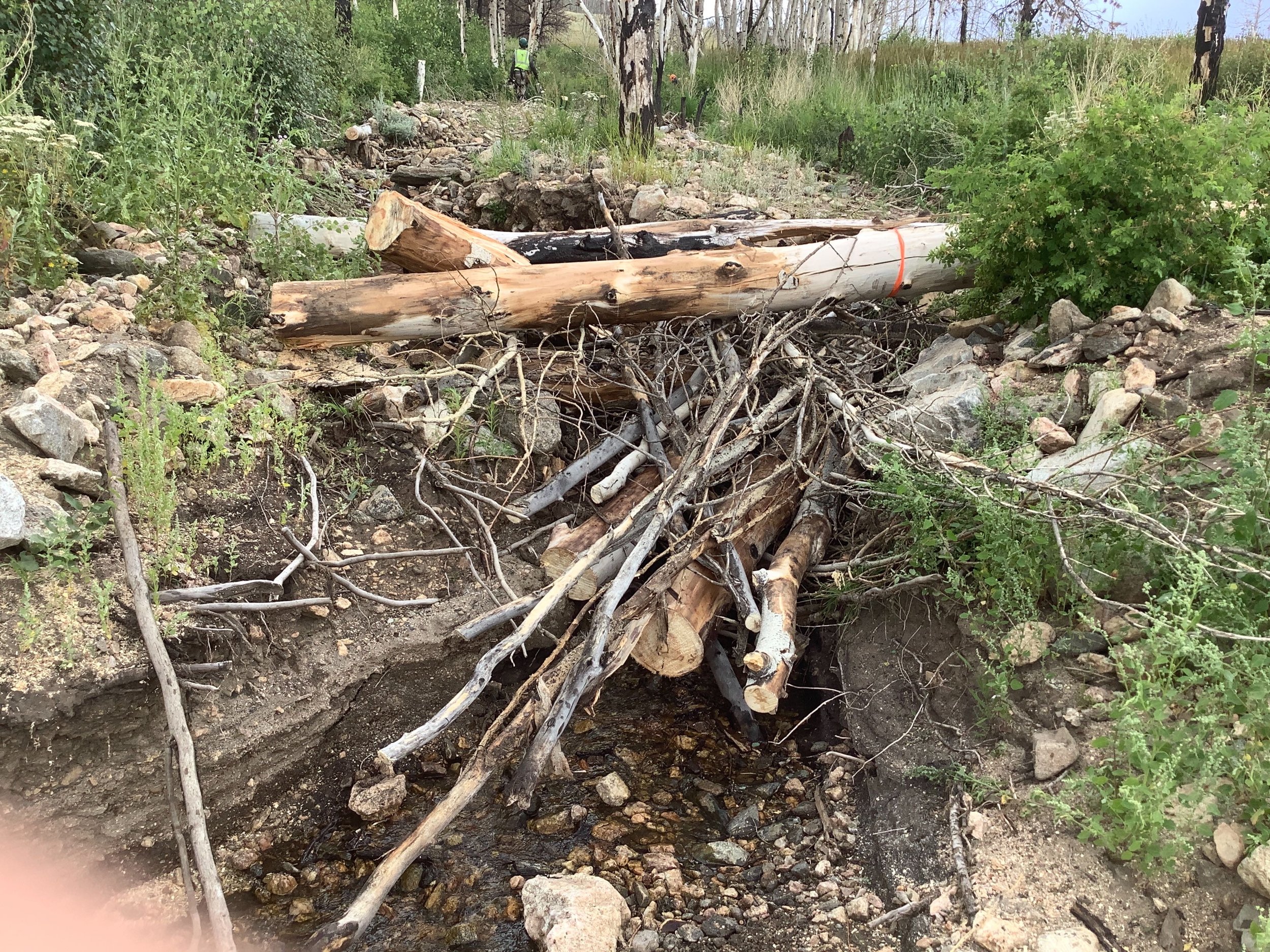
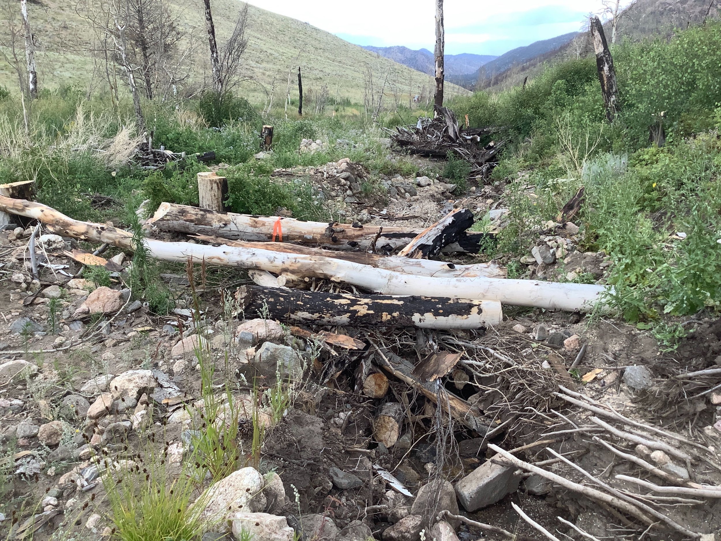
Log Structures (36) – On-site large woody material was strategically placed and interlocked in the channel and on the streambed to initiate and simulate natural wood accumulation. Log Structures provide opportunity for sediment storage behind the structures while promoting floodplain connectivity, additional wood recruitment, aquatic habitat complexity, and riparian health.
Riparian Revegetation - Recovery of riparian ecosystems is vital to improving water quality. Establishing woody riparian vegetation, primarily willows, increases the capacity for sediment storage, nutrient uptake, and habitat complexity in riparian and aquatic ecosystems. These willows were incorporated into the log structures to provide additional support.
Project Goals
Provide opportunities for sediment storage, water quality improvements, and enhanced riparian areas
Decrease water quality degradation due to excess sediment entering the stream system
Use low-tech process-based restoration techniques to meet the project objectives
Project Collaborators
Ayres Associates
AloTerra Restoration Services
Funder(s)
Colorado Department of Public Health and Environment (CDPHE)
Project Timeline
Completed - Summer 2023