Sheep Creek at Sleeping Elephant
Cameron Peak Post-Fire Restoration

Sleeping Elephant pre-construction (Ayres Associates)
Project Overview
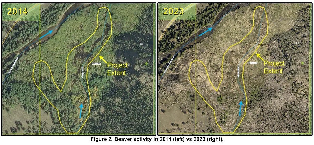
The Sleeping Elephant site offers a unique opportunity to enhance riverscape complexity in an area that has minimal risk to structures and infrastructure. There are no structures located along Sheep Creek. This reach of the Sheep Creek is on an alluvial fan. The channel is generally a single-thread, sinuous stream that lacks channel spanning woody material. As recently as 2014, the floodplain was dominated by beaver dams and beaver meadow complexes. However, the beaver complexes have since been abandoned, leading to incision and floodplain disconnection that is evident today. Additional channel degradation will lead to further disconnection.
The site has experienced significant changes over the last several decades. Property owners report having seen pervasive beaver throughout the Sheep Creek alluvial fan prior to the Cameron Peak Fire. There has been very minimal beaver activity following the fire despite this alluvial fan being dominated by beaver activity in the past. Historic evidence of beaver activity can be seen in aerial imagery (Figure 2 below) as well as in the field.
Post-Fire Treatments
Sheep Creek at Sleeping Elephant plans. Click map to enlarge.
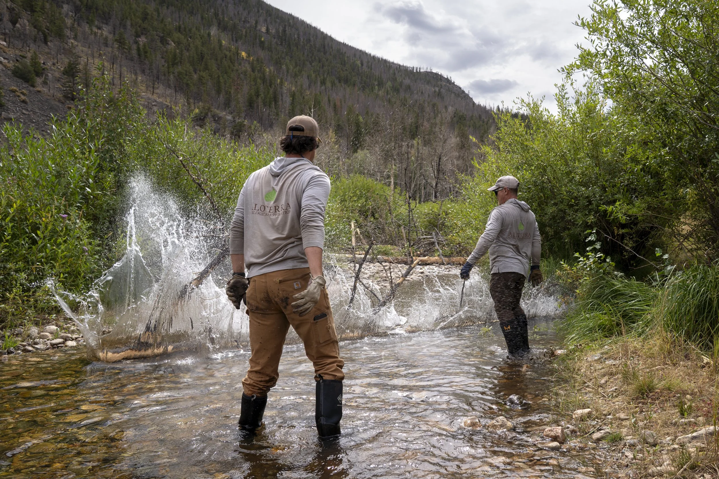
The proposed mitigation would improve water quality and ecological functioning by providing opportunities for sediment storage, nutrient uptake, and enhanced aquatic and riparian habitats. Low-tech process-based mitigation techniques along with planting of native plant materials are proposed to meet the project objectives. All features will be constructed using hand crews. Mitigation features target areas with lower banks and opportunities to encourage more frequent overbank flow. Project features include:
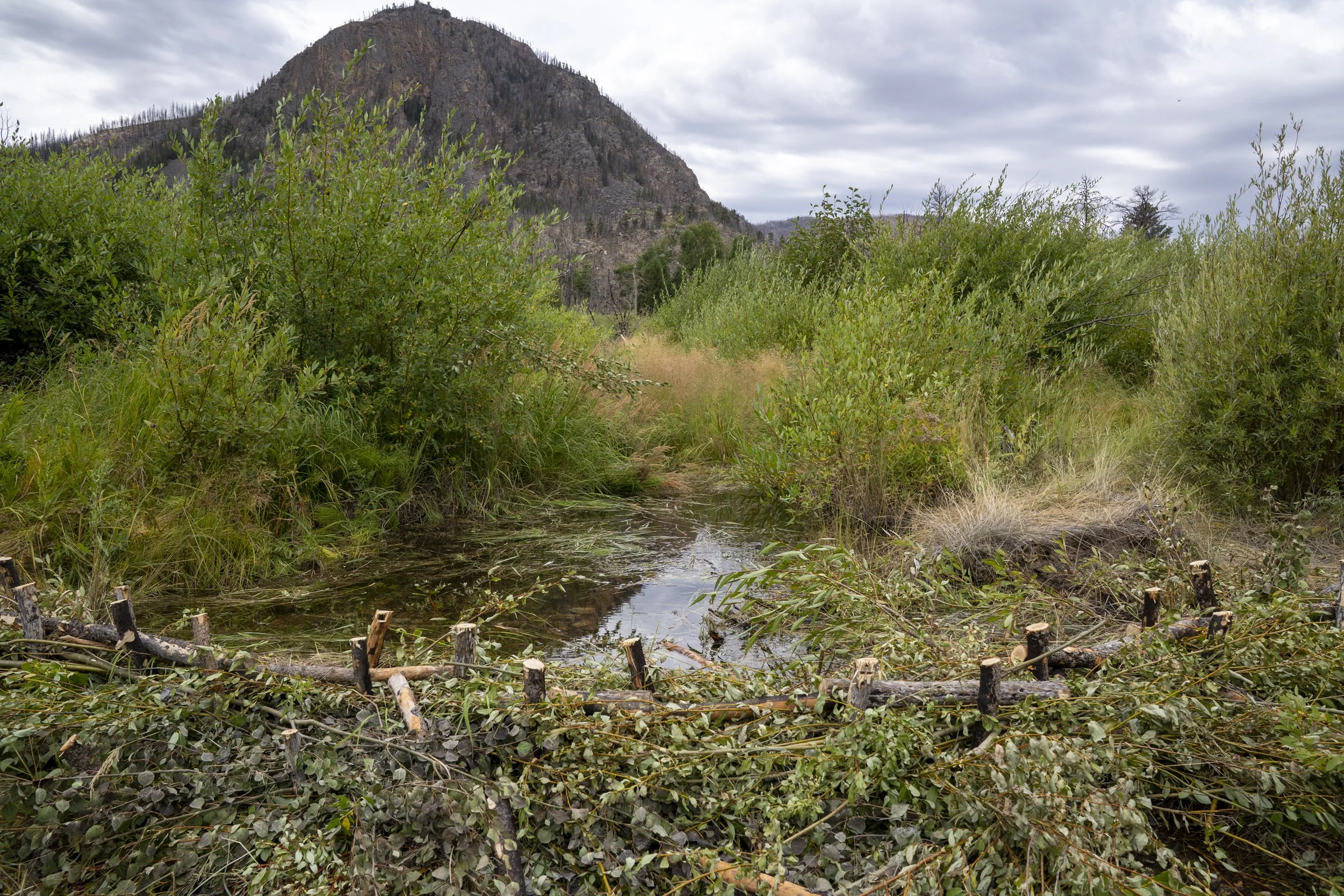
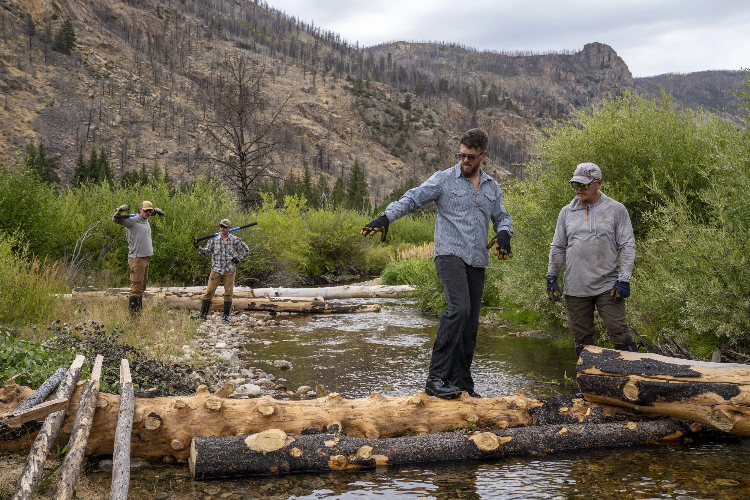
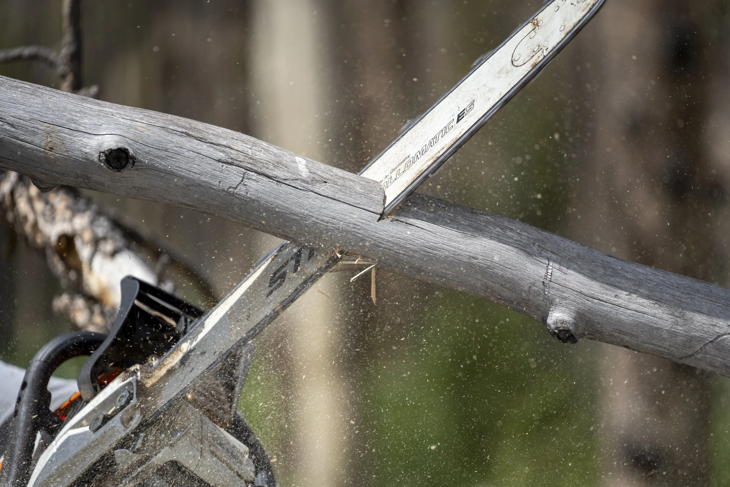
Post Assisted Log Structure (PALS) – On-site logs are stabilized using untreated posts driven into the streambed to initiate and simulate natural wood accumulation. PALS provide opportunities for sediment storage behind the structures while promoting floodplain connectivity, additional wood recruitment, and riparian health. PALS function best in streams with high sediment loading, like the fire-affected Sheep Creek, and in series to allow for wood movement within the system. These features are intended to target annual storm events and are not expected to remain intact during the 100-year flood event.
Burnt logs/trees will be gathered from adjacent areas and used to construct the PALS. Typically, each PALS will have approximately six logs of which two will be at least the channel width. When possible, logs with rootwads will be used to stabilize PALS and create more complexity. Other stabilization techniques include ballasting into existing vegetation or topography and tying with thick manilla rope. The exact location and size of these features will be field fit by the design team at the time of construction.
Log Structures – Burnt trees gathered on-site will be felled, placed, and interlocked in the channel to increase roughness, reduce flow velocity, enhance sediment deposition, and encourage overbank flow during annual storm events and are not expected to remain intact during the 100-year flood event. These features would enhance nutrient uptake while increasing wetland and aquatic habitat value. LS also function best in high sediment load systems in series. They are intended to move over time and interlock with subsequent features.
Proposed features would be strategically placed at locations with observed incision to increase roughness, reduce flow velocities, and promote sediment deposition. These features will be field fit by the design team at the time of installation.
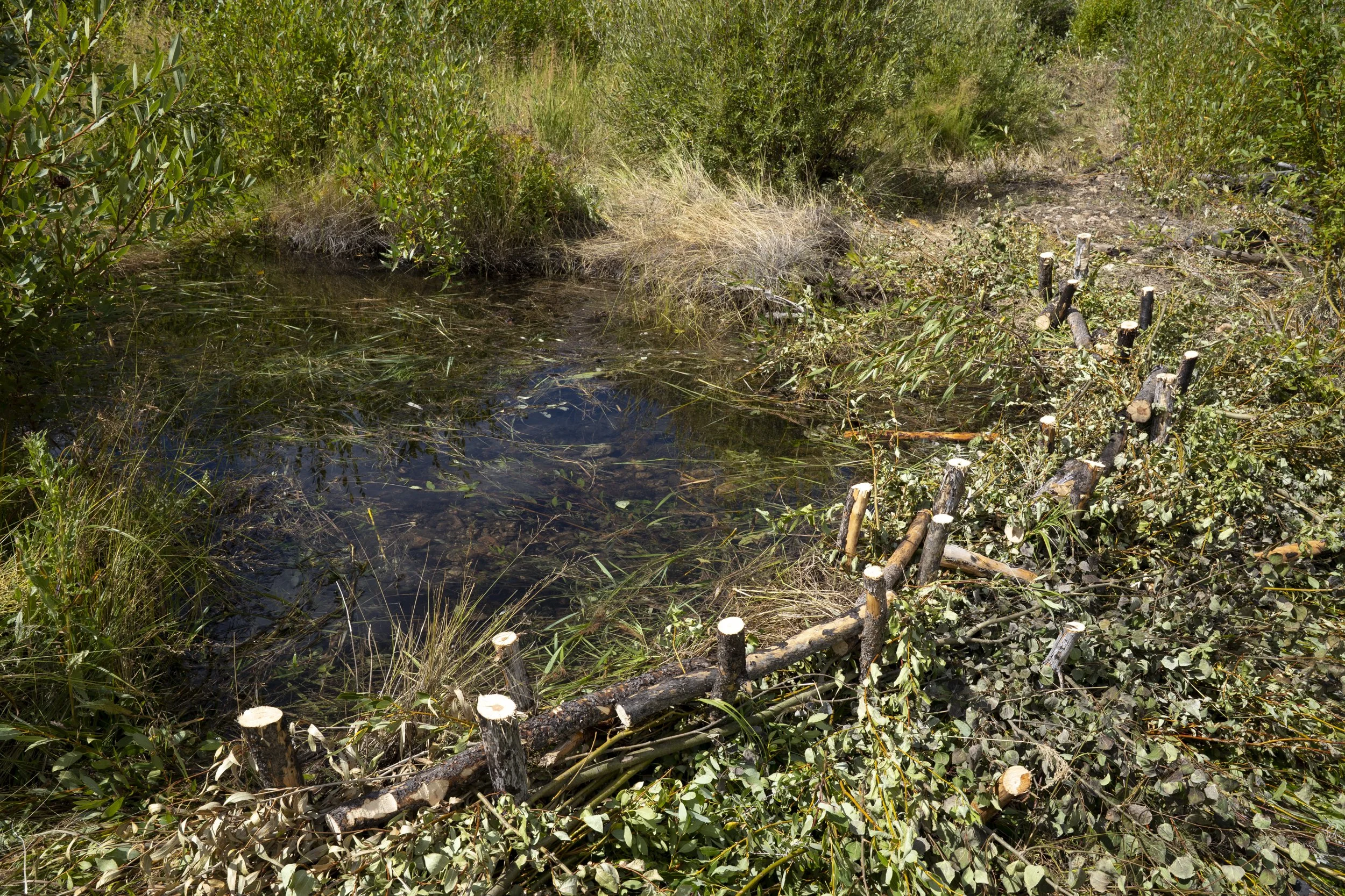
Beaver Dam Analogs (BDA) - BDAs are channel-spanning, semi-permeable structures with a uniform crest elevation constructed using woody debris and fill material to form a pond and mimic natural beaver dams (Wheaton et al., 2019). Woody material and sediment plugs will be gathered on-site and matted together in layers to create a wide berm in secondary channels. Posts will be driven through the structure after reaching the final crest height in order to provide additional stability. BDAs mimic the form and function of natural beaver dams by creating a backwater area behind the structure, which benefits habitat and floodplain connectivity. These features will be field fit by the design team. Note that pervasive beaver dams existed throughout this reach prior to the Cameron Peak Fire and minimal beaver activity was observed in 2023.
Riparian Restoration - Recovery of riparian ecosystems is vital to improving water quality. Establishing woody riparian vegetation such as cottonwoods, willows, and other native plants increases the capacity for sediment storage and nutrient uptake, enhances habitat complexity in riparian and aquatic ecosystems, and facilitates beaver re-establishment. Narrowleaf cottonwoods and willows would be gathered on-site and either planted as cuttings or as containerized stock after being grown in a greenhouse. These plants will be installed at locations with shallow water tables that will support establishment and continued colonization. Mass plantings of cottonwoods would restore gallery forest patches that are now scarce within the watershed. Willows would be installed near in-channel and floodplain mitigation features to provide additional hydraulic roughness and structure stability.
Proposed features would be strategically placed at locations that would encourage more frequent overbank flow during annual flood events. In channel features would contribute to sediment deposition, nutrient uptake, and channel complexity while increasing wetland and aquatic habitat value. The Plans (see map above) show the location of the structures. These locations are subject to minor shifts in location during field fitting and construction activities.

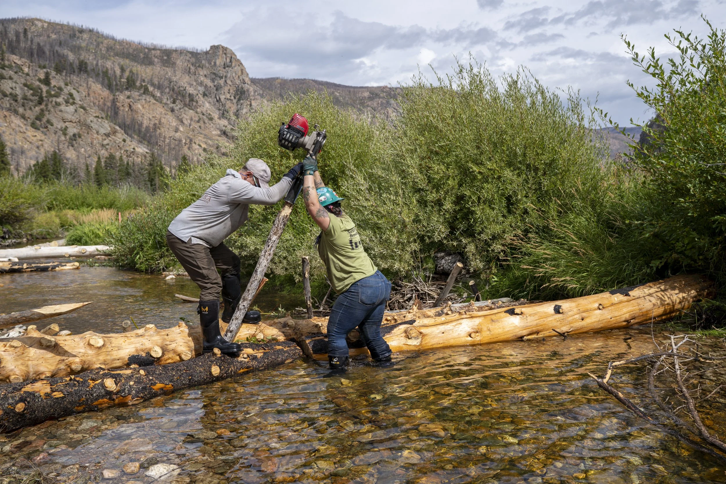
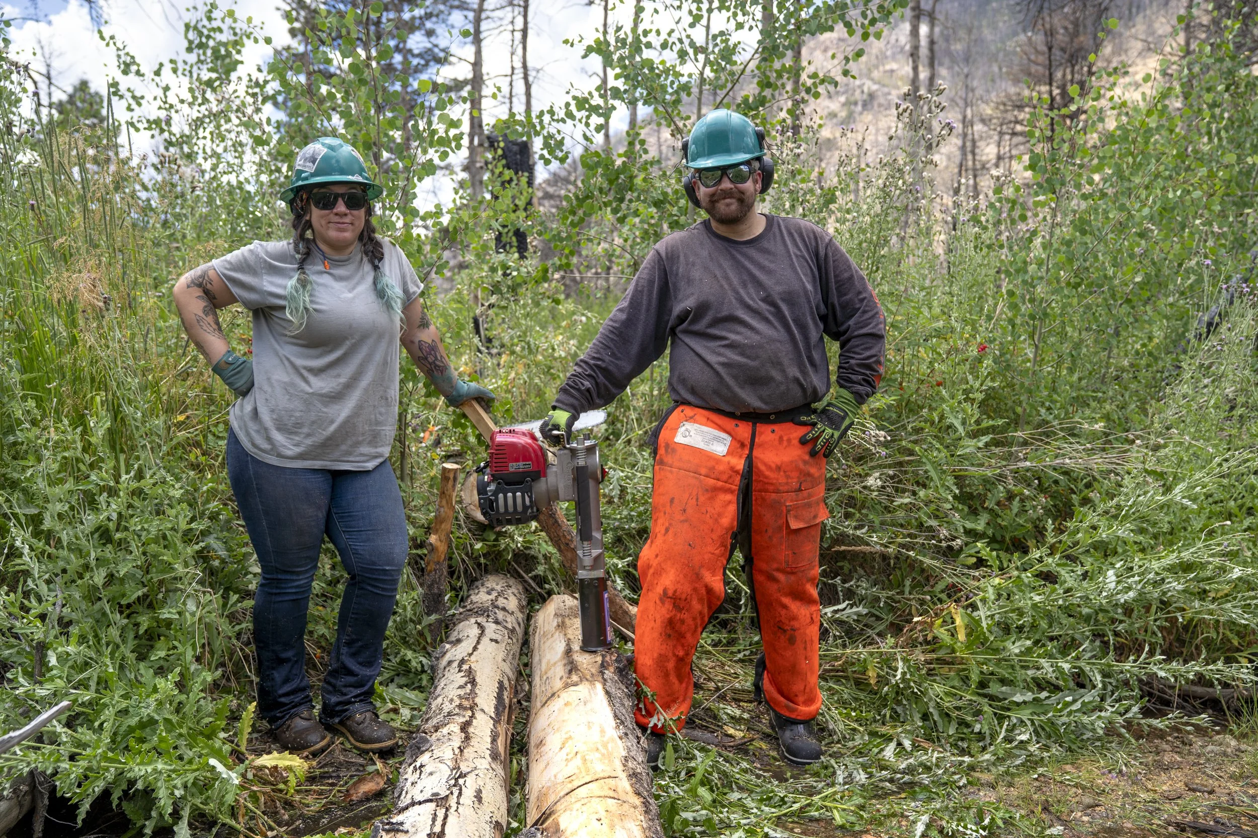

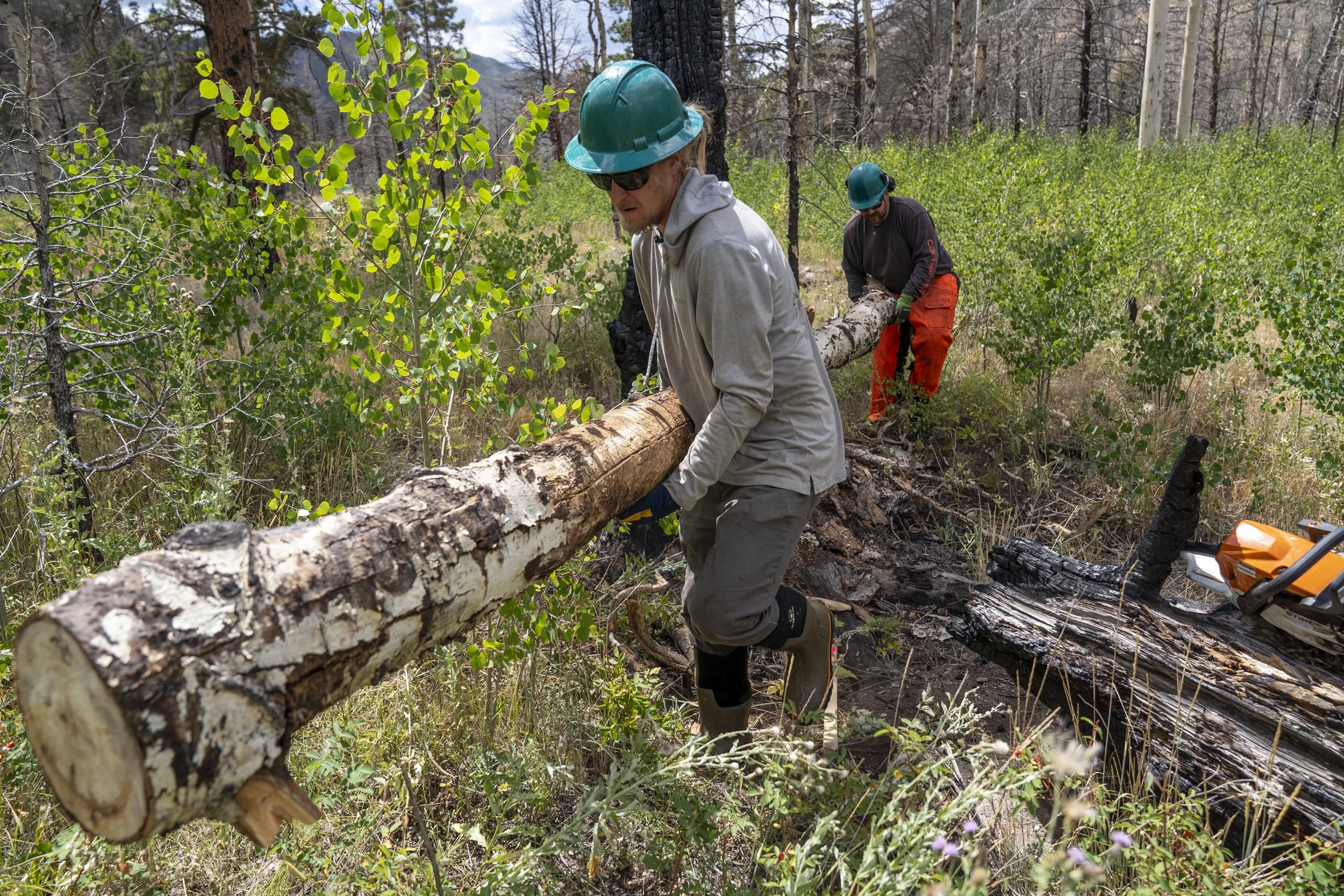
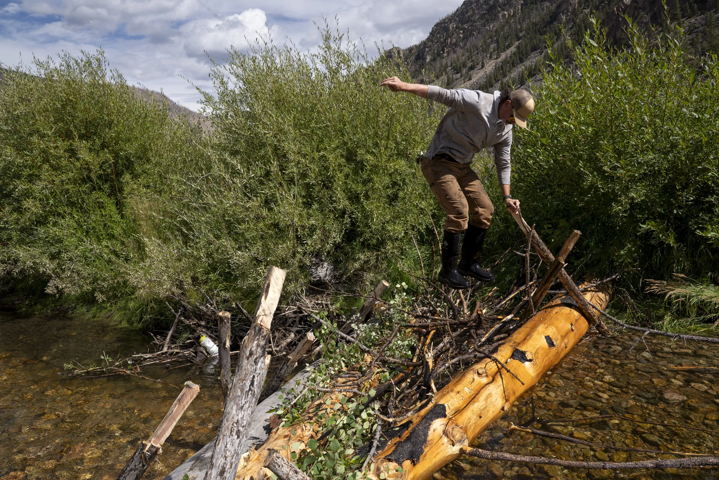

Photos by Evan Barrientos Photography
“We feel incredibly fortunate to have partnered with the Coalition for the Poudre River Watershed on the restoration project at our property following the Cameron Peak Fire. From the very beginning, Taryn and the CPRW team took the time to educate us about the river, streams, and local wildlife, helping us understand how these beaver-mimicking structures would restore habitat and improve stream health. The wildlife and the river are so important to us and to the health and vibrancy of our entire community. It’s wonderful to know that projects like this exist, and we’re proud to be part of creating a more resilient watershed for future generations. We can’t wait to see how the landscape transforms over the coming years. Go beavers!” - Jon Morgan, landowner
Project Goals
Improve water quality and ecological functioning by providing opportunities for sediment storage, nutrient uptake, and enhanced aquatic and riparian habitats.
Improve stream processes in Sheep Creek that align with downstream Wild and Scenic recreation, aesthetic, fisheries, and aquatic habitat values in the Cache la Poudre River.
Use process-based restoration techniques to meet the project objectives.
Project Collaborators
Private landowner
US Forest Service
Ayres Associates (Design & Engineering)
AloTerra Restoration Services (Construction)
Colorado State University (Research & Monitoring)
Funders
Colorado Department of Public Health and Environment (CDPHE)
Colorado Water Conservation Board (CWCB)
Project Timeline
Completed - Summer/Fall 2025