74E Evacuation Route Improvement
Red Feather Lakes Area Wildfire Defense Project

A slash pile created along 74E by the Phantom Canyon Crew - wildfire mitigation in action!
Introduction and Purpose of Project
The Red Feather Lakes Area Wildfire Defense Project, jointly administered by Larimer County Office of Emergency Management and Coalition for the Poudre River Watershed and funded through the US Department of Agriculture Community Wildfire Defense Grant (CWDG) program, focuses on four main objectives to improve wildfire readiness:
1. Reduction of hazardous fuels in open space, along roadways, and on private properties
2. Reduction of risk to properties through hazard assessment and defensible space treatments
3. Improved evacuation plans, procedures, and routes
4. Enhanced community capacity to handle woody biomass generated during these treatments
The 74E Evacuation Route Improvement project was prioritized by the Glacier View Fire Protection District Community Wildfire Protection Plan, and will be implemented by the Larimer County Sheriff’s Office Emergency Services (LCSO ES) wildland crew. This project will address objectives 1, 3, and 4 above.
Project Area & Description
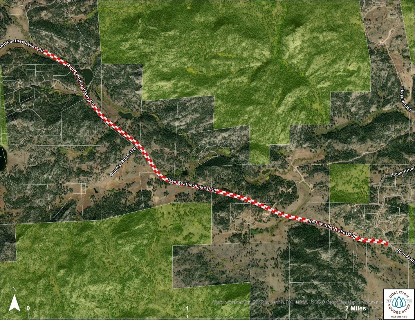
The project area is comprised of the roadway and county road right-of-way of County Road 74E (Red Feather Lakes Rd), between Springmeadow Way on the east and Alpine Elk Ranch Lane on the west, and within the Glacier View Fire Protection District (see map). Forest type in the treatment area is generally ponderosa pine and dry mixed-conifer, with components of aspen and riparian vegetation.
Treatment Objectives
This project will address fuels within the road right-of-way along CR 74E, in order to improve the route as an evacuation corridor, reduce wildfire intensity should a wildfire occur along the road, and improve sight lines for emergency response personnel using the road.
Treatment Prescription
Cut all trees <12” DBH, between the road edge and existing fencelines (all species, including aspen)
Consider leaving any trees obviously cared for by landowners near driveways but within the right-of-way, as long as they do not block line of sight
If there is no fenceline, cut to approximately 30’ from the centerline of the road
Limb/prune all trees >=12” DBH to at least 14’ above the ground surface
Prune all low-hanging branches coming from across the fenceline back at least to the fenceline
Stumps should be left as low as possible (6” max height), and flat-topped
Do not leave any cut material within the roadway
Pile slash (all material <6” in diameter) in large, accessible piles along the roadway, outside of the roadway clear zone (16’ from the road edge)
Stack all firewood (all material >6” diameter) in manageable (4’ to 6’ length) sections, neatly along the roadway, outside of the roadway clear zone (16’ from the road edge)
Remove and pile sound dead and down fuels
Ensure that line of sight is maintained for safe public roadway use, as well as safe entrance and exit from private driveways
Do not operate any tracked equipment on the road surface
Use traffic control signage in both directions
Keep Larimer County Right-of-Way Construction Permit with the crew at all times, and follow any specifications on that permit not included in this prescription
Reseed all disturbed areas with approved Larimer County seed mix
Project Timeline: Fall 2025
Project Collaborators
Coalition for the Poudre River Watershed (CPRW)
Larimer County Office of Emergency Management
Larimer County Sheriff’s Office Emergency Services
Livermore Fire Protection District
Funders
U.S. Forest Service - Community Wildfire Defense Grant (CWDG)