Rivers Program
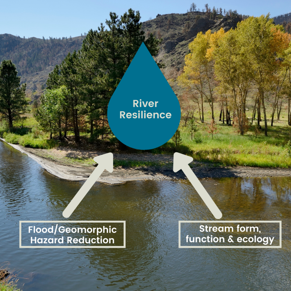
The Coalition for the Poudre River Watershed’s Rivers Program is active throughout the entire Cache la Poudre Watershed, from the headwaters to the confluence with the South Platte in Greeley. The overall goal of this work is to create a more resilient Poudre Watershed. The term “resilience” is simply defined as the ability to recover quickly from difficulties or challenges. When rivers are more resilient, they are better prepared for events such as flooding and wildfire and more likely to recover in a cost-effective and timely manner.
CPRW’s river resilience work is multi-disciplinary in nature and based on work from a variety of fields of science including ecology, hydrology and geomorphology. Our strategy is to reduce the risk of high severity wildfire, reduce flooding risk, and improve habitat and river corridor function.
Each of our river restoration projects requires different restoration techniques based on the location of the project and restoration goals for that unique location.
Using a science-based approach plus collaborative planning with partners throughout the watershed, our team analyzes the needs of each stretch of river or section of tributary to determine what kind of restoration should be applied.
Project Prioritization
In the Lower Poudre Watershed, CPRW and partners have prioritized reaches for restoration along the river corridor east of I-25 to the confluence with the South Platte. Those can be found in our Lower Poudre Resiliency Plan. Our Upper Poudre Watershed Resilience Plan identifies target areas and prioritization of actions within those areas that would increase watershed resilience.
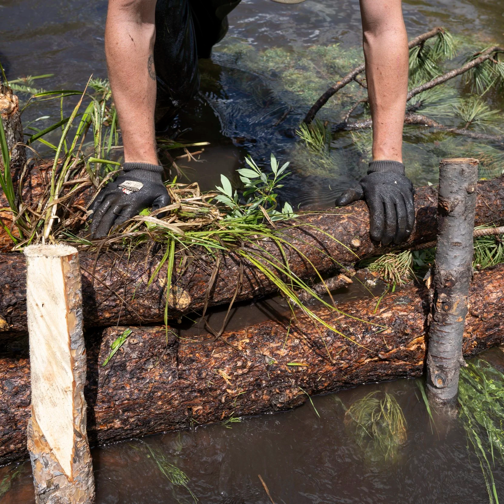
Low-Tech Process-Based Restoration
CPRW is working to restore degraded or damaged riverscape ecosystems using natural processes.

Report: Floodplain Development Permitting for Process-Based Restoration
Prepared by Ayres Associates
Featured River Restoration Projects
Elkhorn Creek at the Scout Ranch
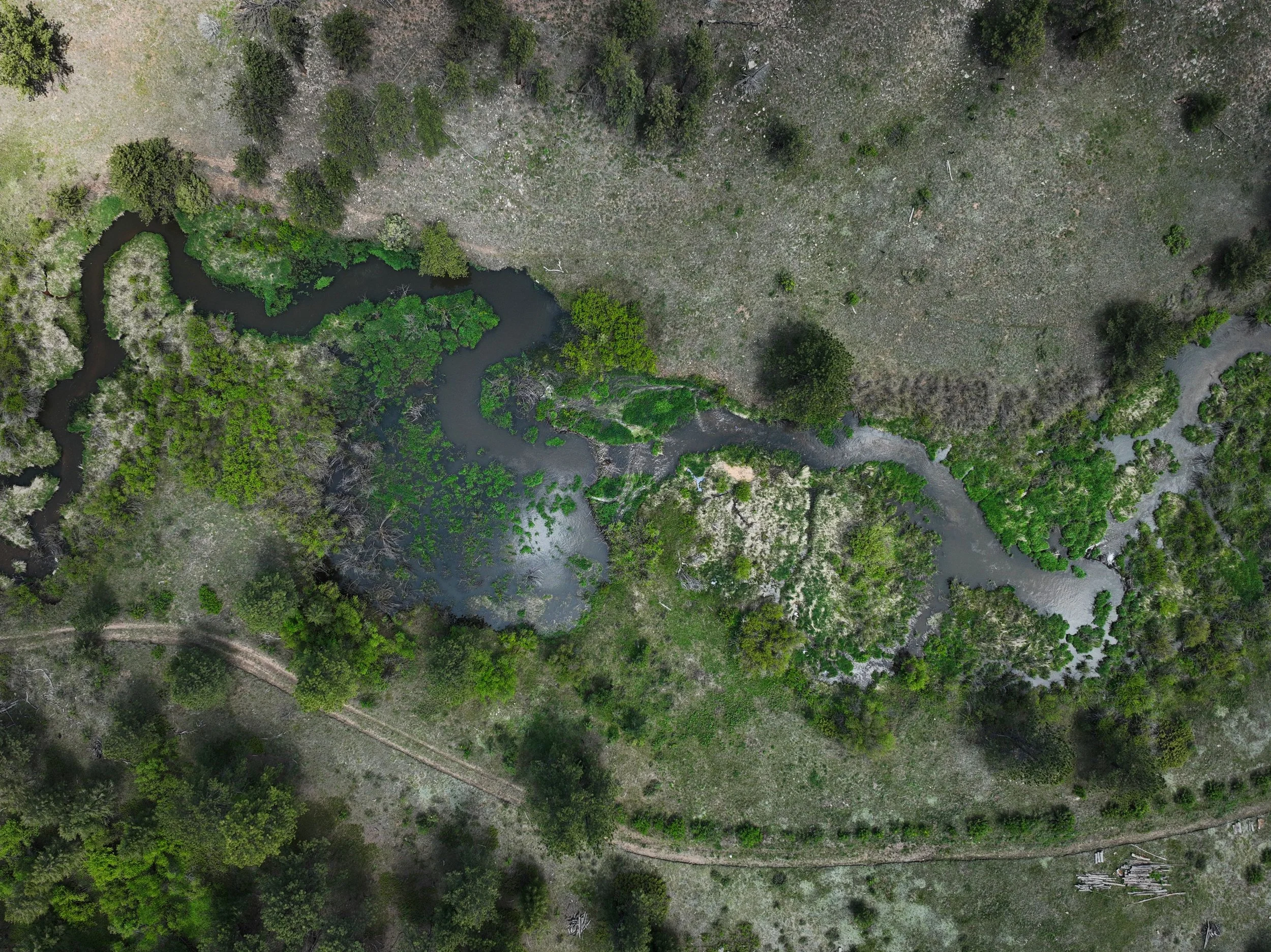
The Larimer Conservation District (LCD) and Coalition for the Poudre River Watershed (CPRW) have partnered to restore 3 miles of Elkhorn Creek, a priority stream for restoration identified by CPRW’s Upper Poudre Resilience Master Plan. This project will seek to address impacts to the Elkhorn Creek stream corridor caused by historical grazing, loss of beaver, and disturbance from the 2020 Cameron Peak Fire using low-tech process-based restoration (LTPBR) and riparian revegetation to improve the geomorphic and hydrologic functionality of the stream and its surrounding floodplain.

Post-Fire River Restoration (Upper Poudre Watershed)
Using process-based restoration techniques, CPRW and partners are working to address critical post-fire issues in high-priority watersheds that were impacted by the historic Cameron Peak Fire of 2020. Following large-scale fires like Cameron Peak, burn areas have a higher potential for increased runoff, stream flows and erosion in streams and gullies, causing water quality issues that persist for many years.

Godfrey Ditch Restoration Project
The purpose of the Godfrey Ditch Diversion Structure Reconstruction project is to improve the resiliency of a section of the Middle South Platte River by designing and reconstructing the Godfrey Ditch diversion.

Whitney & B.H Eaton Ditch Restoration Project
This is a multi-objective planning and design/build project that will further river resiliency goals on the Cache la Poudre River, while providing immediate benefits to local ditch companies.

“Reach 13” Phase 2 Design Project
CPRW has been awarded funding from the Bureau of Reclamation WaterSMART Cooperative Watershed Management Program to continue design work on one of our priority reaches as identified in the Lower Poudre Master Plan.

“Reach 16” at Signature Bluffs
Reach 16 starts at the location of the Greeley Number 3 headgate and then travels around a large bend where larger cobbles have been deposited. The historical river channel changed after the 1983 flood event. Public observations point out lots of flooding in this reach.